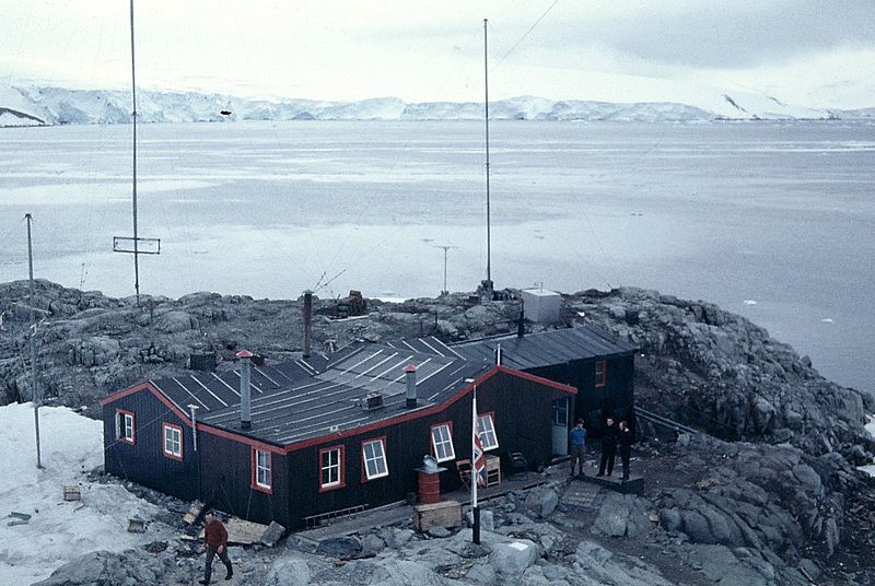
File:Puerto Lockroy4.JPG
From Wikimedia Commons, the free media repository
Jump to navigation
Jump to search

Size of this preview: 800 × 536 pixels. Other resolutions: 320 × 214 pixels | 640 × 429 pixels | 1,024 × 686 pixels | 1,280 × 857 pixels | 1,840 × 1,232 pixels.
Original file (1,840 × 1,232 pixels, file size: 601 KB, MIME type: image/jpeg)
File information
Structured data
Captions
Captions
Add a one-line explanation of what this file represents
Summary
[edit]| DescriptionPuerto Lockroy4.JPG | Base inglesa "A" ubicada en puerto Lockroy, isla Wiencke. Latitud: 64,8S. La base desarrollaba observaciones de la ionósfera en relación con las condiciones de propagación radiotelegráfica. Estaba cubierta por 5 científicos. |
| Date | |
| Source | Trabajo propio con mi Voighlander Vito II |
| Author | Jorge Valdés R. User:Jorval:Jorval |
| Permission (Reusing this file) |
Ver más abajo |
| Camera location | 64° 49′ 00″ S, 63° 30′ 00″ W | View this and other nearby images on: OpenStreetMap |
|---|
Licensing
[edit]| Public domainPublic domainfalsefalse |
| I, the copyright holder of this work, release this work into the public domain. This applies worldwide. In some countries this may not be legally possible; if so: I grant anyone the right to use this work for any purpose, without any conditions, unless such conditions are required by law. |
File history
Click on a date/time to view the file as it appeared at that time.
| Date/Time | Thumbnail | Dimensions | User | Comment | |
|---|---|---|---|---|---|
| current | 17:38, 12 February 2007 |  | 1,840 × 1,232 (601 KB) | Jorval (talk | contribs) | {{Information |Description=Base inglesa "A" ubicada en puerto Lockroy, isla Wiencke. Latitud: 64,8S. La base desarrollaba observaciones de la ionósfera en relación con las condiciones de propagación radiotelegráfica. Estaba cubierta por 5 científicos |
You cannot overwrite this file.
File usage on Commons
There are no pages that use this file.
Metadata
This file contains additional information such as Exif metadata which may have been added by the digital camera, scanner, or software program used to create or digitize it. If the file has been modified from its original state, some details such as the timestamp may not fully reflect those of the original file. The timestamp is only as accurate as the clock in the camera, and it may be completely wrong.
| Camera manufacturer | FUJI PHOTO FILM CO., LTD. |
|---|---|
| Camera model | SP-3000 |
| Date and time of data generation | Unknown date |
| Author | Picasa 2.6 |
| Orientation | 0 |
| Horizontal resolution | 72 dpi |
| Vertical resolution | 72 dpi |
| Software used | FDi V4.5 / FRONTIER355/375-1.7-0E-093 |
| File change date and time | 11:24, 26 January 2007 |
| Y and C positioning | Centered |
| Exif version | 2.1 |
| Date and time of digitizing | 11:24, 26 January 2007 |
| Meaning of each component |
|
| Supported Flashpix version | 1 |
| Color space | Uncalibrated |
| File source | Digital still camera |
| Scene type | A directly photographed image |
| Unique image ID | 6fba94953eb98e922bbc07837f91eb48 |