File:Publication de l'Histoire de Charleville — Plan de la Ville de Charleville (1854).jpg
Jump to navigation
Jump to search

Size of this preview: 472 × 599 pixels. Other resolutions: 189 × 240 pixels | 378 × 480 pixels | 605 × 768 pixels | 807 × 1,024 pixels | 1,674 × 2,124 pixels.
Original file (1,674 × 2,124 pixels, file size: 1.87 MB, MIME type: image/jpeg)
Captions
Captions
Add a one-line explanation of what this file represents
Summary
[edit].jpg&action=edit§ion=1)
| Description |
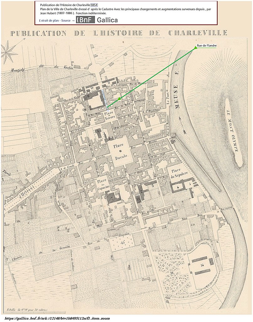
Français : Charleville-Mézières (France - département des Ardennes) — Repérage de la rue de Flandre* – Extrait du plan de la Ville de Charleville issu de la "Publication de l'Histoire de Charleville" (1854) par Jean Hubert. -Photo** de cette rue et commentaires sur le site Canopé Reims (http://www.cndp.fr/crdp-reims/) et sur ce site.
|
| Date | |
| Source |
BnF (Bibliothèque Nationale de France - site internet : Gallica. – Page : https://gallica.bnf.fr/ark:/12148/btv1b8495112n |
| Author | Publication de l'Histoire de Charleville. Plan de la Ville de Charleville dressé d'après le Cadastre, avec les principaux changements et augmentations survenues depuis, par Jean Hubert (1854) |
| Camera location | | View this and other nearby images on: OpenStreetMap |
|---|
.jpg¶ms=049.774463_N_0004.716771_E_globe:Earth_type:camera__&language=en)
Licensing
[edit].jpg&action=edit§ion=2)
|
This work is in the public domain in its country of origin and other countries and areas where the copyright term is the author's life plus 70 years or fewer. This work is in the public domain in the United States because it was published (or registered with the U.S. Copyright Office) before January 1, 1929. | |
| This file has been identified as being free of known restrictions under copyright law, including all related and neighboring rights. | |
File history
Click on a date/time to view the file as it appeared at that time.
| Date/Time | Thumbnail | Dimensions | User | Comment | |
|---|---|---|---|---|---|
| current | 22:40, 5 March 2021 | | 1,674 × 2,124 (1.87 MB) | Jpcuvelier (talk | contribs) | Uploaded a work by Publication de l'Histoire de Charleville. Plan de la Ville de Charleville dressé d'après le Cadastre, avec les principaux changements et augmentations survenues depuis, par Jean Hubert (1854) from BnF (Bibliothèque Nationale de France - site internet : Gallica.<br>* https://gallica.bnf.fr/ark:/12148/btv1b8495112n with UploadWizard |
You cannot overwrite this file.
File usage on Commons
There are no pages that use this file.
.jpg&oldid=594583248)