File:Public waterpath^ - geograph.org.uk - 484910.jpg
Jump to navigation
Jump to search
Size of this preview: 400 × 600 pixels. Other resolutions: 160 × 240 pixels | 427 × 640 pixels.
Original file (427 × 640 pixels, file size: 153 KB, MIME type: image/jpeg)
Captions
Captions
Add a one-line explanation of what this file represents
Summary
[edit]
| Description |
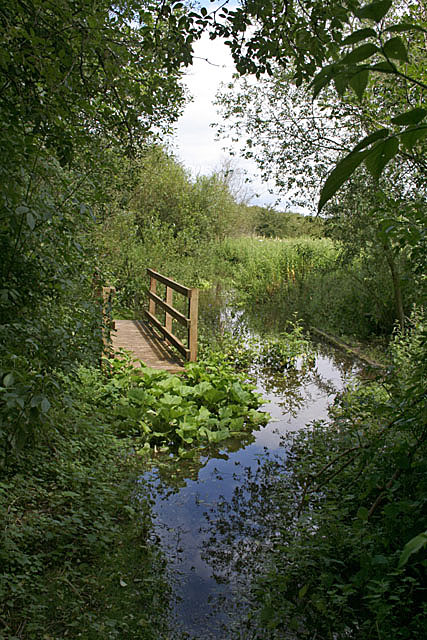
English: Public waterpath! The footbridge is of little assistance following the heavy rains of the preceding days. This was part of a meander of the River Trent until it cut through around the end of the 18th century. The area remains swampy but is not a true oxbow lake. |
| Date | |
| Source | From geograph.org.uk |
| Author | Alan Murray-Rust |
| Attribution (required by the license) | Alan Murray-Rust / Public waterpath! / |
| Camera location | | View this and other nearby images on: OpenStreetMap |
|---|
_heading:22.00&language=en)
| Object location | | View this and other nearby images on: OpenStreetMap |
|---|
_heading:22.00&language=en)
Licensing
[edit]

|
This image was taken from the Geograph project collection. See this photograph's page on the Geograph website for the photographer's contact details. The copyright on this image is owned by Alan Murray-Rust and is licensed for reuse under the Creative Commons Attribution-ShareAlike 2.0 license.
|
This file is licensed under the Creative Commons Attribution-Share Alike 2.0 Generic license.
Attribution: Alan Murray-Rust
- You are free:
- to share – to copy, distribute and transmit the work
- to remix – to adapt the work
- Under the following conditions:
- attribution – You must give appropriate credit, provide a link to the license, and indicate if changes were made. You may do so in any reasonable manner, but not in any way that suggests the licensor endorses you or your use.
- share alike – If you remix, transform, or build upon the material, you must distribute your contributions under the same or compatible license as the original.
File history
Click on a date/time to view the file as it appeared at that time.
| Date/Time | Thumbnail | Dimensions | User | Comment | |
|---|---|---|---|---|---|
| current | 04:53, 31 December 2011 | | 427 × 640 (153 KB) | Rotatebot (talk | contribs) | Bot: Reset EXIF-specified Orientation of image (EXIF-Orientation set from 6 to 1, rotated 0°) |
| 02:23, 5 February 2011 |  | 640 × 427 (153 KB) | GeographBot (talk | contribs) | == {{int:filedesc}} == {{Information |description={{en|1=Public waterpath! The footbridge is of little assistance following the heavy rains of the preceding days. This was part of a meander of the River Trent until it cut through around the end of the 18t |
You cannot overwrite this file.
File usage on Commons
There are no pages that use this file.