File:Profiles from Australia and New Zealand with model trajectories.jpeg
Jump to navigation
Jump to search
Size of this preview: 800 × 513 pixels. Other resolutions: 320 × 205 pixels | 640 × 410 pixels | 1,024 × 656 pixels | 1,280 × 820 pixels | 2,245 × 1,439 pixels.
Original file (2,245 × 1,439 pixels, file size: 1.38 MB, MIME type: image/jpeg)
Captions
Captions
Add a one-line explanation of what this file represents
Summary
[edit]
| Description |
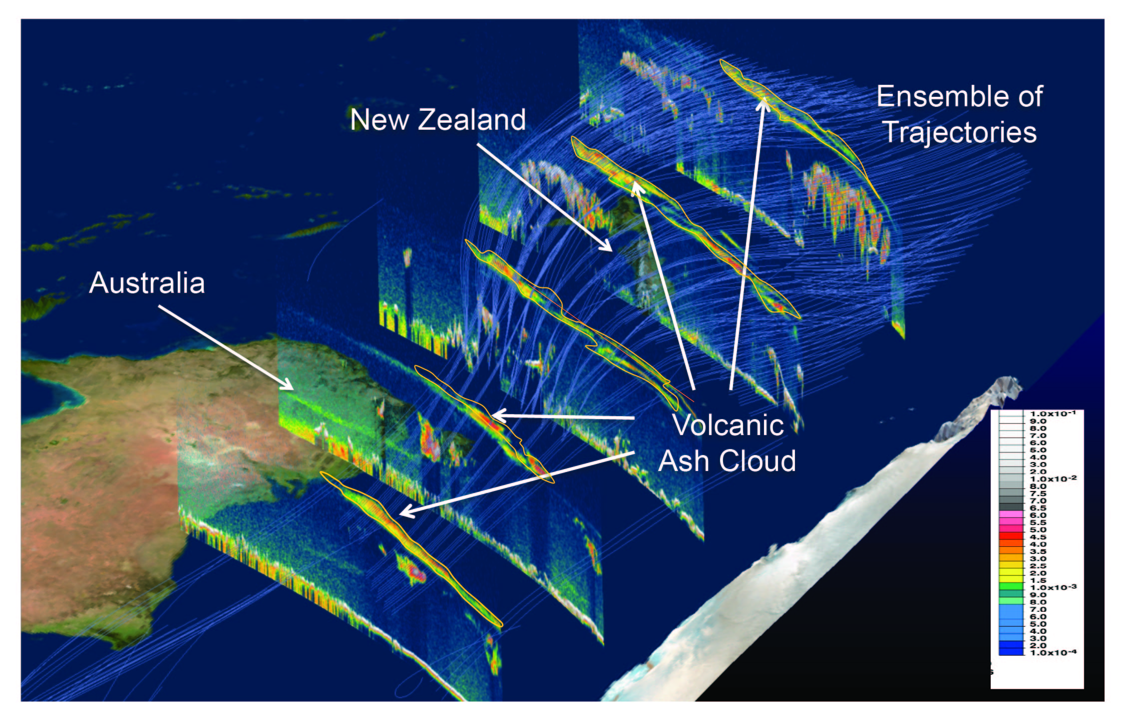
English: NASA's CALIPSO satellite mission is uniquely suited to provide updated information about ash plume height and location. Shown here are CALIPSO, or Cloud Aerosol–Lidar and Infrared Pathfinder Satellite Observations, data profiles from Australia and New Zealand with model trajectories. |
| Date | |
| Source | http://www.nasa.gov/larc/volcanic-ash-aviation/index.html |
| Author | NASA |
Licensing
[edit]
| This file is in the public domain in the United States because it was solely created by NASA. NASA copyright policy states that "NASA material is not protected by copyright unless noted". (See Template:PD-USGov, NASA copyright policy page or JPL Image Use Policy.) | ||
 |
Warnings:
|
File history
Click on a date/time to view the file as it appeared at that time.
| Date/Time | Thumbnail | Dimensions | User | Comment | |
|---|---|---|---|---|---|
| current | 16:22, 26 October 2013 | | 2,245 × 1,439 (1.38 MB) | Stas1995 (talk | contribs) | User created page with UploadWizard |
You cannot overwrite this file.
File usage on Commons
The following page uses this file:
File usage on other wikis
The following other wikis use this file:
- Usage on fr.wikipedia.org