File:Princess Elizabeth Land stub map.png
Jump to navigation
Jump to search
No higher resolution available.
Princess_Elizabeth_Land_stub_map.png (275 × 334 pixels, file size: 21 KB, MIME type: image/png)
Captions
Captions
Add a one-line explanation of what this file represents
| Description |
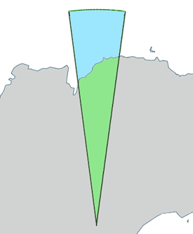
English: Outline map of w:Princess Elizabeth Land, Antarctica. |
| Source | Generated from File:Antarctica,_territorial_claims.svg (Lokal_Profil) by myself (w:User:Grutness) |
| Author | w:User:Grutness |
This file is licensed under the Creative Commons Attribution-Share Alike 2.5 Generic license.
Attribution: Lokal_Profil
- You are free:
- to share – to copy, distribute and transmit the work
- to remix – to adapt the work
- Under the following conditions:
- attribution – You must give appropriate credit, provide a link to the license, and indicate if changes were made. You may do so in any reasonable manner, but not in any way that suggests the licensor endorses you or your use.
- share alike – If you remix, transform, or build upon the material, you must distribute your contributions under the same or compatible license as the original.
File history
Click on a date/time to view the file as it appeared at that time.
| Date/Time | Thumbnail | Dimensions | User | Comment | |
|---|---|---|---|---|---|
| current | 07:06, 9 July 2011 | | 275 × 334 (21 KB) | Grutness (talk | contribs) | Outline map of Princess Elizabeth Land, Antarctica. Generated from File:Antarctica,_territorial_claims.svg ({{cc-by-sa-2.5|Lokal_Profil}}) by myself (User:Grutness) |
You cannot overwrite this file.
File usage on Commons
There are no pages that use this file.
File usage on other wikis
The following other wikis use this file:
- Usage on en.wikipedia.org
- Gardner Island
- Barrier Bay
- Manning Island
- Anchorage Island, Princess Elizabeth Land
- Prydz Bay
- Ingrid Christensen Coast
- Polar Times Glacier
- Grove Mountains
- Leopold and Astrid Coast
- Zavadovskiy Island
- Leskov Island (Antarctica)
- Mikhaylov Island
- Mount Brown (Antarctica)
- Lake Zvezda
- Zakharoff Ridge
- Progress Station
- Debutante Island
- Young Peak
- Suter Island
- Il Polo Glacier
- Lake Jabs
- Publications Ice Shelf
- Holder Peak
- American Highland
- Larsemann Hills
- Walkabout Rocks
- Sansom Islands
- Tryne Islands
- Wilson Ridge
- Anchorage Patch
- Barratt Island
- Black Nunataks
- Blundell Peak
- Bode Nunataks
- Bølingen Islands
- Boyd Nunatak
- Branstetter Rocks
- Brattstrand Bluffs
- Braunsteffer Lake
- Breidnes Peninsula
- Browns Glacier
- Bryse Peaks
- Mount Caroline Mikkelsen
- Wyatt Earp Islands
- Chaos Glacier
- Cleft Island (Antarctica)
- O'Gorman Rocks
- Club Lake
- Collerson Lake
- Cooke Peak
View more global usage of this file.