File:Prenton War Memorial.jpg
Jump to navigation
Jump to search

Size of this preview: 375 × 598 pixels. Other resolutions: 150 × 240 pixels | 301 × 480 pixels | 481 × 768 pixels | 641 × 1,024 pixels | 1,283 × 2,048 pixels | 3,192 × 5,094 pixels.
Original file (3,192 × 5,094 pixels, file size: 16.32 MB, MIME type: image/jpeg)
Captions
Captions
Add a one-line explanation of what this file represents
Summary
[edit]
| Description |
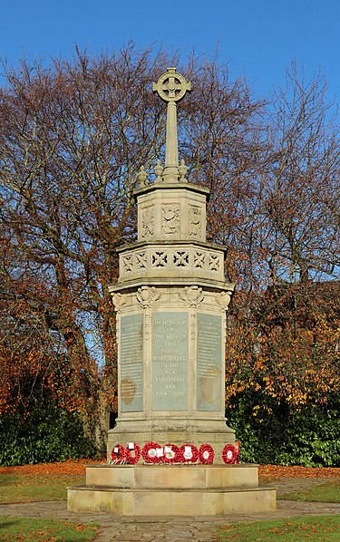
English: Grade II listed war memorial at the corner of Osmaston Road and Prenton Lane, Prenton, Birkenhead. Erected in 1921, it was badly damaged in the blitz of 1941 and later reconstructed. Refurbished in 2014.
|
|
| Date | ||
| Source | Own work | |
| Author | Rodhullandemu |
| Object location | | View this and other nearby images on: OpenStreetMap |
|---|
Licensing
[edit]
I, the copyright holder of this work, hereby publish it under the following license:
This file is licensed under the Creative Commons Attribution-Share Alike 4.0 International license.
- You are free:
- to share – to copy, distribute and transmit the work
- to remix – to adapt the work
- Under the following conditions:
- attribution – You must give appropriate credit, provide a link to the license, and indicate if changes were made. You may do so in any reasonable manner, but not in any way that suggests the licensor endorses you or your use.
- share alike – If you remix, transform, or build upon the material, you must distribute your contributions under the same or compatible license as the original.
This image has been assessed using the Quality image guidelines and is considered a Quality image.
|

|
This image has been assessed under the valued image criteria and is considered the most valued image on Commons within the scope: Prenton war memorial. You can see its nomination here. |
File history
Click on a date/time to view the file as it appeared at that time.
| Date/Time | Thumbnail | Dimensions | User | Comment | |
|---|---|---|---|---|---|
| current | 09:26, 15 November 2018 | | 3,192 × 5,094 (16.32 MB) | Rodhullandemu (talk | contribs) | Dust spots- |
| 12:47, 14 November 2018 |  | 3,192 × 5,094 (16.09 MB) | Rodhullandemu (talk | contribs) | User created page with UploadWizard |
You cannot overwrite this file.
File usage on Commons
The following 6 pages use this file:
File usage on other wikis
The following other wikis use this file:
- Usage on en.wikipedia.org
- Usage on www.wikidata.org