File:Precipitation Ohio NA.png
Jump to navigation
Jump to search

Size of this preview: 711 × 599 pixels. Other resolutions: 285 × 240 pixels | 570 × 480 pixels | 911 × 768 pixels | 1,215 × 1,024 pixels | 1,578 × 1,330 pixels.
Original file (1,578 × 1,330 pixels, file size: 211 KB, MIME type: image/png)
Captions
Captions
Add a one-line explanation of what this file represents
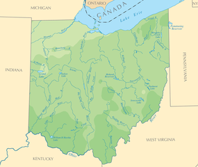
| Description | Map of Ohio (Precipitation) |
| Source | National Atlas |
| Author | National Atlas |
| Permission (Reusing this file) |
PD |
This map was obtained from an edition of the National Atlas of the United States. Like almost all works of the U.S. federal government, works from the National Atlas are in the public domain in the United States.
Online access: NationalAtlas.gov | 1970 print edition: Library of Congress, Perry-Castañeda Library
|
File history
Click on a date/time to view the file as it appeared at that time.
| Date/Time | Thumbnail | Dimensions | User | Comment | |
|---|---|---|---|---|---|
| current | 16:19, 2 January 2010 | | 1,578 × 1,330 (211 KB) | Shell Kinney (talk | contribs) | borders removed |
| 19:45, 12 September 2006 |  | 2,112 × 1,632 (332 KB) | Mortadelo2005 (talk | contribs) | {{Information| |Description=Map of Ohio (Precipitation) |Source=[http://www.nationalatlas.gov National Atlas]|Date= |Author=National Atlas |Permission=PD }} Category:Maps of Ohio {{PD-USGov-Atlas}} |
You cannot overwrite this file.
File usage on Commons
There are no pages that use this file.
File usage on other wikis
The following other wikis use this file:
- Usage on bg.wikipedia.org
- Usage on es.wikipedia.org
- Usage on gl.wikipedia.org