File:Postal Map of Shanghai Showing Sectional Divisions in 1930 (cropped).jpg

Original file (14,920 × 11,259 pixels, file size: 18.1 MB, MIME type: image/jpeg)
Captions
Captions
Summary
[edit]| Description |
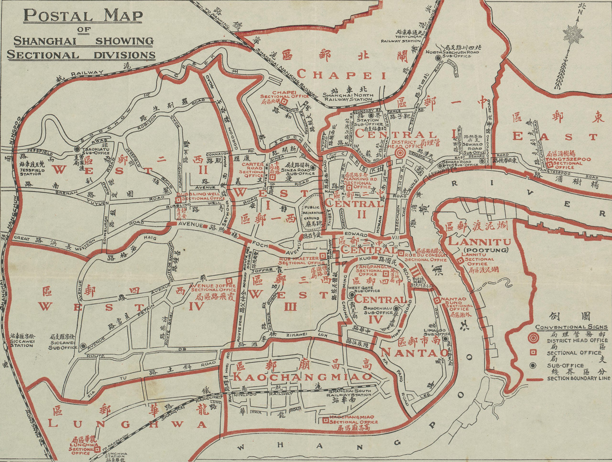
中文(简体):上海分区邮局地图
中文(繁體):上海分區郵局地圖
English: Map of the International Settlement and the French Concession, Shanghai, showing sectional post offices. This map was issued by the Shanghai postal authorities to accompany the division of the Shanghai area into postal sections. The accompanying instructions to residents are printed in English, Chinese and French. |
| Date | |
| Source | http://nla.gov.au/nla.map-brsc7 |
| Author | Unknown author |
| Other versions |

.jpg&action=edit§ion=1)
| Warning | The original file is very high-resolution. It might not load properly or could cause your browser to freeze when opened at full size. |
|---|
.jpg&flash=no)
Licensing
[edit].jpg&action=edit§ion=2)
This image is now in the public domain in China because its term of copyright has expired. According to copyright laws of the People's Republic of China (with legal jurisdiction in the mainland only, excluding Hong Kong and Macao), amended November 11, 2020, Works of legal persons or organizations without legal personality, or service works, or audiovisual works, enter the public domain 50 years after they were first published, or if unpublished 50 years from creation. For photography works of natural persons whose copyright protection period expires before June 1, 2021 belong to the public domain. All other works of natural persons enter the public domain 50 years after the death of the creator. To uploader: Please provide where the image was first published and who created it or held its copyright.
|
  |
File history
Click on a date/time to view the file as it appeared at that time.
| Date/Time | Thumbnail | Dimensions | User | Comment | |
|---|---|---|---|---|---|
| current | 17:04, 17 May 2019 | | 14,920 × 11,259 (18.1 MB) | Tibet Nation (talk | contribs) | File:Postal map of Shanghai 1930.jpg cropped 19 % horizontally, 36 % vertically using CropTool with lossless mode. |
You cannot overwrite this file.
File usage on Commons
The following 6 pages use this file:
- User:Chumwa/OgreBot/Potential transport maps/2019 May 11-20
- User:Chumwa/OgreBot/Public transport information/2019 May 11-20
- User:Chumwa/OgreBot/Transport Maps/2019 May 11-20
- User:Chumwa/OgreBot/Travel and communication maps/2019 May 11-20
- User:Ww2censor/Recent philatelic uploads/2019 May
- File:Postal map of Shanghai 1930.jpg
.jpg&oldid=743051327)
- 1930 in Shanghai
- 1930 maps of China
- Multilingual maps
- Chinese-language maps of China
- English-language maps of China
- Maps in the National Library of Australia
- Old maps of Shanghai
- Chinese postal maps
- Rail transport maps
- Shanghai French Concession
- Shanghai International Settlement
- Bilingual Chinese-English signs in China