File:Porto Corsini planimetria.jpg
Jump to navigation
Jump to search
Size of this preview: 753 × 600 pixels. Other resolutions: 301 × 240 pixels | 603 × 480 pixels | 777 × 619 pixels.
Original file (777 × 619 pixels, file size: 196 KB, MIME type: image/jpeg)
Captions
Captions
Add a one-line explanation of what this file represents
Summary
[edit]
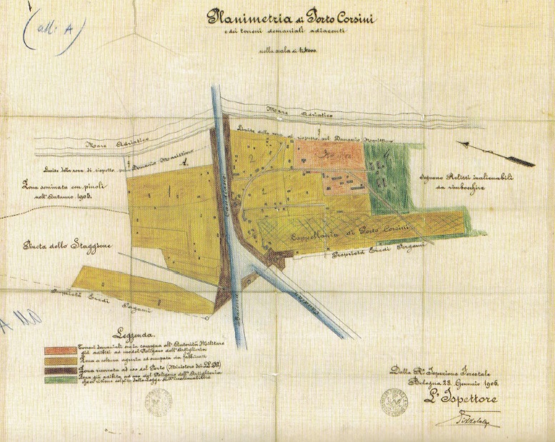
| Description | Plan of the Porto Corsini area. |
| Date | |
| Source | Antonio Graziani, La Romagna della via Emilia: fra gli anni ’20 e gli anni ’70, Menabò, Forlì 2004. |
| Author | Giovannino Bernabei |
Licensing
[edit]
|
This work is in the public domain in its country of origin and other countries and areas where the copyright term is the author's life plus 70 years or fewer. This work is in the public domain in the United States because it was published (or registered with the U.S. Copyright Office) before January 1, 1929. | |
| This file has been identified as being free of known restrictions under copyright law, including all related and neighboring rights. | |
Original upload log
[edit]
The original description page was here. All following user names refer to it.wikipedia.
| Date/Time | Dimensions | User | Comment |
|---|---|---|---|
| 2014-04-04 19:30 | 777×619× (201158 bytes) | Sentruper | Giovannino Bernabei. Planimetria dell'area di Porto Corsini, risalente al [[1906]]. |
File history
Click on a date/time to view the file as it appeared at that time.
| Date/Time | Thumbnail | Dimensions | User | Comment | |
|---|---|---|---|---|---|
| current | 23:39, 29 September 2014 | | 777 × 619 (196 KB) | AlessioMela (talk | contribs) | Transferred from it.wikipedia |
You cannot overwrite this file.
File usage on Commons
There are no pages that use this file.
File usage on other wikis
The following other wikis use this file:
- Usage on fr.wikipedia.org
- Usage on it.wikipedia.org