File:Port Stephens headlands from Salamander Bay 01 annotated.jpg
Jump to navigation
Jump to search

Size of this preview: 800 × 450 pixels. Other resolutions: 320 × 180 pixels | 640 × 360 pixels | 1,024 × 575 pixels | 1,280 × 719 pixels | 2,560 × 1,439 pixels | 4,000 × 2,248 pixels.
Original file (4,000 × 2,248 pixels, file size: 565 KB, MIME type: image/jpeg)
Captions
Captions
Add a one-line explanation of what this file represents

Summary
[edit]
| Description |
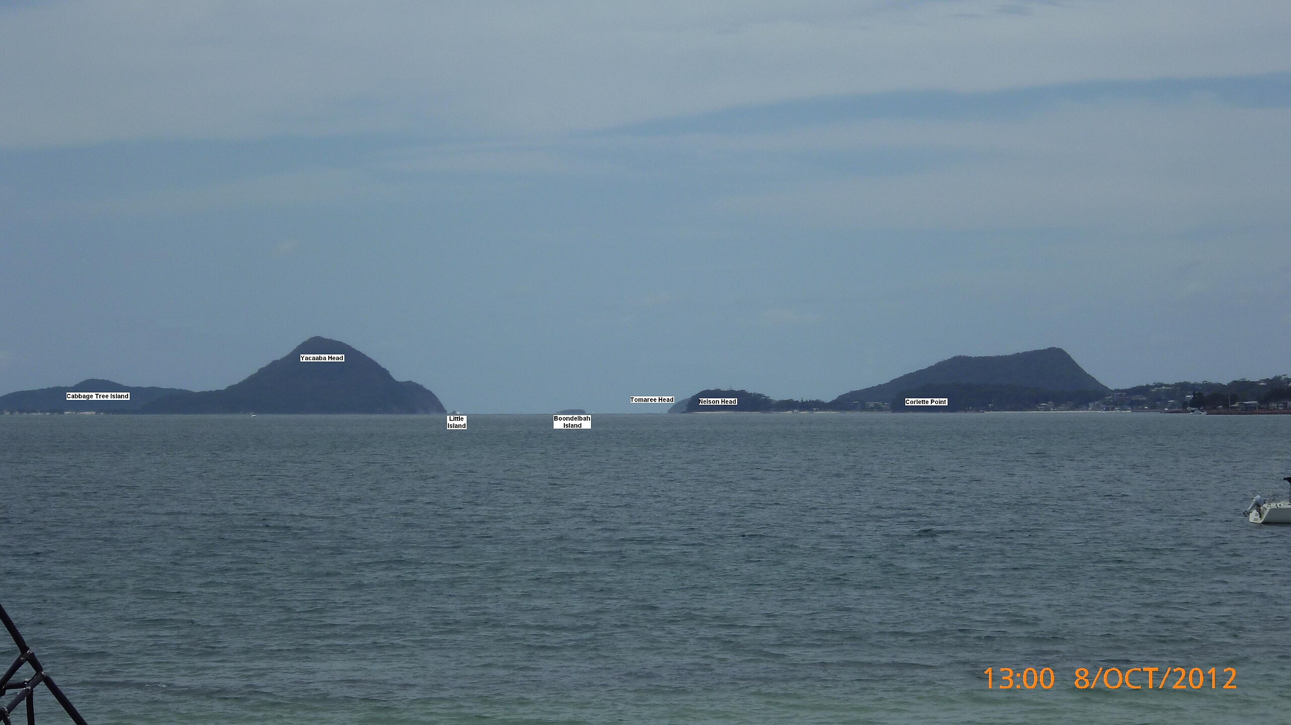
View from Salamander Bay east towards the mouth of Port Stephens (approximately 12 km (7.5 mi) away) in New South Wales, Australia. This is an annotated version of File:Port Stephens headlands from Soldiers Point 01.jpg. Approximate distances to the labelled features, from left to right, are:
|
| Date | |
| Source | Own work |
| Author | AussieLegend |
| Other versions |
This file was derived from: Port Stephens headlands from Salamander Bay 01.jpg:  |
| Camera location | | View this and other nearby images on: OpenStreetMap |
|---|
Licensing
[edit]
| I, the copyright holder of this work, release this work into the public domain. This applies worldwide. In some countries this may not be legally possible; if so: I grant anyone the right to use this work for any purpose, without any conditions, unless such conditions are required by law. |
File history
Click on a date/time to view the file as it appeared at that time.
| Date/Time | Thumbnail | Dimensions | User | Comment | |
|---|---|---|---|---|---|
| current | 14:30, 14 October 2012 | | 4,000 × 2,248 (565 KB) | AussieLegend (talk | contribs) | == {{int:filedesc}} == {{Information |description = View from Salamander Bay east towards the mouth of Port Stephens in New South Wales, Australia. This is an annotated version of [[:File... |
You cannot overwrite this file.
File usage on Commons
The following page uses this file: