File:Pony Springs, Nevada.jpg

Original file (1,280 × 960 pixels, file size: 243 KB, MIME type: image/jpeg)
Captions
Captions
Summary
[edit]
| Description |
In the U.S. state of Nevada, U.S. Route 93 (US 93) is a major United States Highway traversing the eastern edge of the state. The highway connects the Las Vegas area to the Great Basin National Park, and provides further connections to Ely and Wells. US 93 also provides the majority of the most direct connection between the major metropolitan areas of Las Vegas and Phoenix (via Boulder City, Kingman and Wickenburg with a final link to Phoenix via US 60). U.S. Route 93 in Nevada is known as the Great Basin Highway throughout the state. It begins at the Mike O'Callaghan – Pat Tillman Memorial Bridge in Boulder City. The highway overlaps U.S. Route 95 for 3.2 miles from an interchange between downtown Boulder City and the Railroad Pass Hotel and Casino to Interstate 215. It runs to the Las Vegas Valley passing through the cities of Henderson, Las Vegas and North Las Vegas. U.S. 93 merges with Interstate 15 at the Spaghetti Bowl interchange and overlaps I-15 for approximately 21 miles. After overlapping I-15, U.S. 93 heads northwest towards Alamo. Near Crystal Springs, U.S. 93 curves right while intersecting State Routes 318 and 375. U.S. 93 continues east to mountainous terrain to the town of Caliente. The highway turns left to go north to Pioche. 80 miles later, the highway turns left at an intersection with U.S. Routes 6 and 50. From State Route 318 to the US Routes 6 and 50 intersection, the highway is a Nevada Scenic Byway. Near Ely, the three U.S. routes separate. U.S. 6 turns left before the intersection U.S. 50 and 93 separate, heading southwest. U.S. 50 and 93 separate, with route 50 heading northwest towards Austin, Nevada and route 93 heading northeast. In Lages Station, U.S. 93 turns left, while U.S. 93 Alternate continues straight. In Wells, U.S. 93 intersects Interstate 80. The highway continues into Idaho after passing through Jackpot. en.wikipedia.org/wiki/U.S._Route_93_in_Nevada en.wikipedia.org/wiki/Wikipedia:Text_of_Creative_Commons_... |
| Date | |
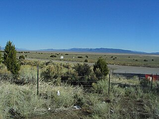
| Source | Pony Springs, U.S. Route 93 North of Pioche, Nevada |
| Author | Ken Lund from Reno, Nevada, USA |
| Camera location | | View this and other nearby images on: OpenStreetMap |
|---|
Licensing
[edit]
- You are free:
- to share – to copy, distribute and transmit the work
- to remix – to adapt the work
- Under the following conditions:
- attribution – You must give appropriate credit, provide a link to the license, and indicate if changes were made. You may do so in any reasonable manner, but not in any way that suggests the licensor endorses you or your use.
- share alike – If you remix, transform, or build upon the material, you must distribute your contributions under the same or compatible license as the original.
| This image was originally posted to Flickr by Ken Lund at https://flickr.com/photos/75683070@N00/427979308. It was reviewed on 17 January 2017 by FlickreviewR and was confirmed to be licensed under the terms of the cc-by-sa-2.0. |
File history
Click on a date/time to view the file as it appeared at that time.
| Date/Time | Thumbnail | Dimensions | User | Comment | |
|---|---|---|---|---|---|
| current | 21:48, 17 January 2017 | | 1,280 × 960 (243 KB) | Kingofthedead (talk | contribs) | Transferred from Flickr via Flickr2Commons |
You cannot overwrite this file.
File usage on Commons
There are no pages that use this file.
File usage on other wikis
The following other wikis use this file:
- Usage on azb.wikipedia.org
- Usage on es.wikipedia.org
- Usage on fa.wikipedia.org
- Usage on nv.wikipedia.org
- Usage on pt.wikipedia.org
- Usage on www.wikidata.org