File:Ponte Romana dos Três Concelhos - Sambal - Portugal (20875768138).jpg
Jump to navigation
Jump to search

Size of this preview: 800 × 533 pixels. Other resolutions: 320 × 213 pixels | 640 × 427 pixels | 1,024 × 683 pixels | 1,280 × 853 pixels | 2,560 × 1,707 pixels | 3,828 × 2,552 pixels.
Original file (3,828 × 2,552 pixels, file size: 4.16 MB, MIME type: image/jpeg)
Captions
Captions
Add a one-line explanation of what this file represents
Summary
[edit].jpg&action=edit§ion=1)
| Description |
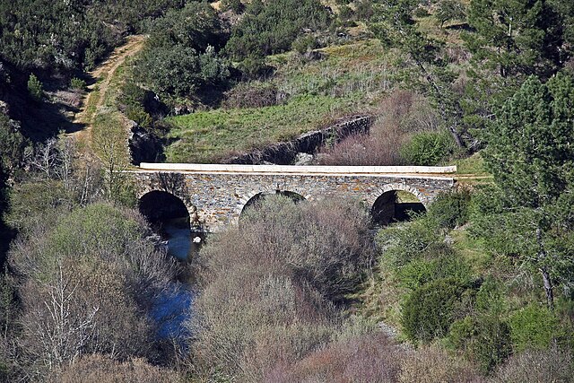
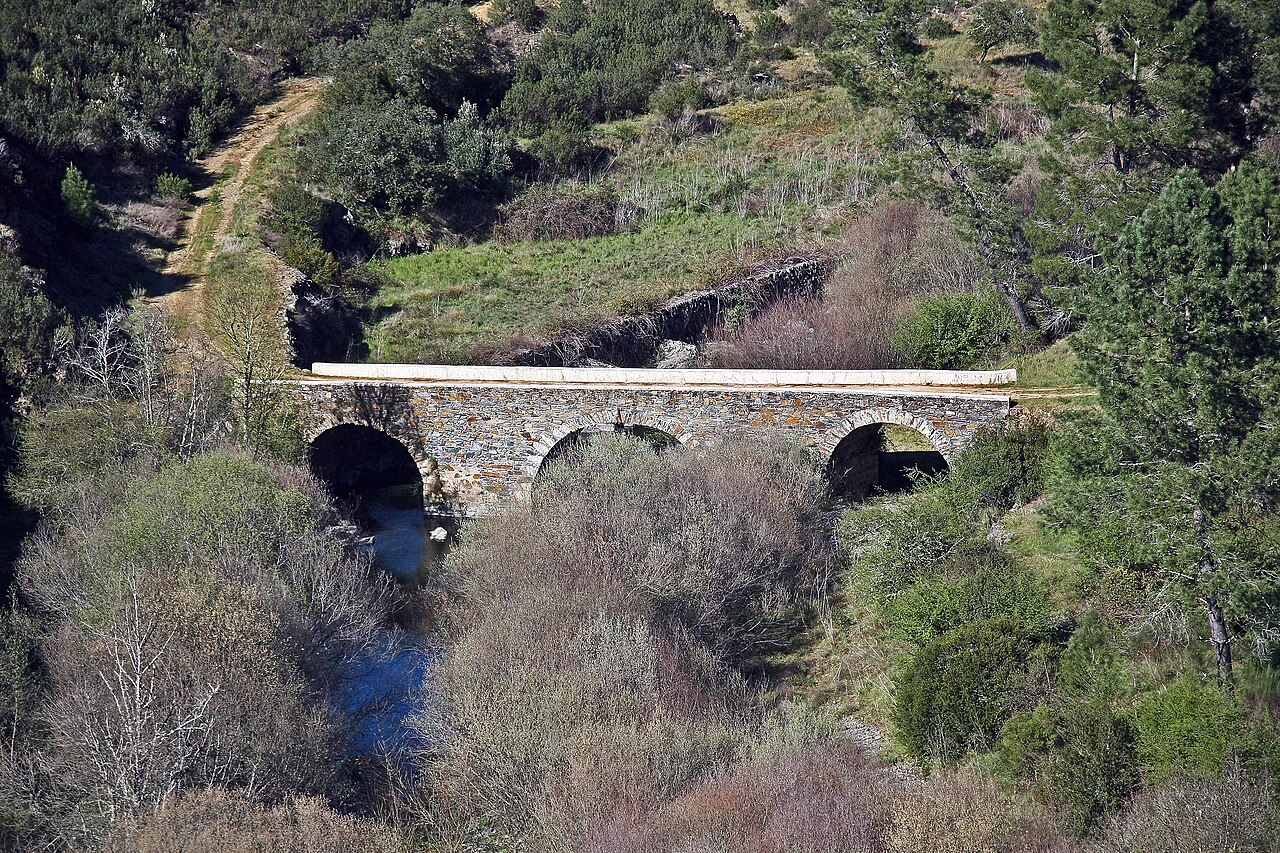
A ponte dos Três Concelhos situa-se junto à povoação do Sambal, na freguesia do Marmeleiro, sobre a ribeira da Isna, fazendo fronteira com os concelhos de Vila de Rei e Mação. Esta ponte romana fazia parte de uma antiga via romana que ligava Mérida (Espanha) a Conímbriga. Coordenadas GPS: N 39º 44'08.88" W 8º 03'18.49" <a href="http://turismo.cm-serta.pt/turismopt/patrim%C3%B3nio-cultural/monumentos/marmeleiro/ponte-dos-tr%C3%AAs-concelhos" rel="nofollow">turismo.cm-serta.pt/turismopt/patrim%C3%B3nio-cultural/mo...</a> |
| Date | |
| Source | Ponte Romana dos Três Concelhos - Sambal - Portugal |
| Author | Vitor Oliveira from Torres Vedras, PORTUGAL |
| Camera location | | View this and other nearby images on: OpenStreetMap |
|---|
.jpg¶ms=039.733506_N_-008.057046_E_globe:Earth_type:camera_source:Flickr_&language=en)
Licensing
[edit].jpg&action=edit§ion=2)
This file is licensed under the Creative Commons Attribution-Share Alike 2.0 Generic license.
- You are free:
- to share – to copy, distribute and transmit the work
- to remix – to adapt the work
- Under the following conditions:
- attribution – You must give appropriate credit, provide a link to the license, and indicate if changes were made. You may do so in any reasonable manner, but not in any way that suggests the licensor endorses you or your use.
- share alike – If you remix, transform, or build upon the material, you must distribute your contributions under the same or compatible license as the original.
| This image was originally posted to Flickr by Portuguese_eyes at https://flickr.com/photos/21446942@N00/20875768138 (archive). It was reviewed on 14 May 2019 by FlickreviewR 2 and was confirmed to be licensed under the terms of the cc-by-sa-2.0. |
File history
Click on a date/time to view the file as it appeared at that time.
| Date/Time | Thumbnail | Dimensions | User | Comment | |
|---|---|---|---|---|---|
| current | 22:01, 16 June 2024 | | 3,828 × 2,552 (4.16 MB) | ReneeWrites (talk | contribs) | Removed watermark |
| 19:59, 14 May 2019 |  | 3,828 × 2,552 (3.81 MB) | Tm (talk | contribs) | Transferred from Flickr via #flickr2commons |
You cannot overwrite this file.
File usage on Commons
The following page uses this file:
File usage on other wikis
The following other wikis use this file:
- Usage on en.wikipedia.org
- Usage on es.wikipedia.org
- Usage on pt.wikipedia.org
- Usage on www.wikidata.org
.jpg&oldid=934008679)