File:Pone.0066293.g011.png
Jump to navigation
Jump to search

Size of this preview: 800 × 574 pixels. Other resolutions: 320 × 230 pixels | 640 × 459 pixels | 1,024 × 735 pixels | 1,280 × 919 pixels | 2,065 × 1,482 pixels.
Original file (2,065 × 1,482 pixels, file size: 7.2 MB, MIME type: image/png)
Captions
Captions
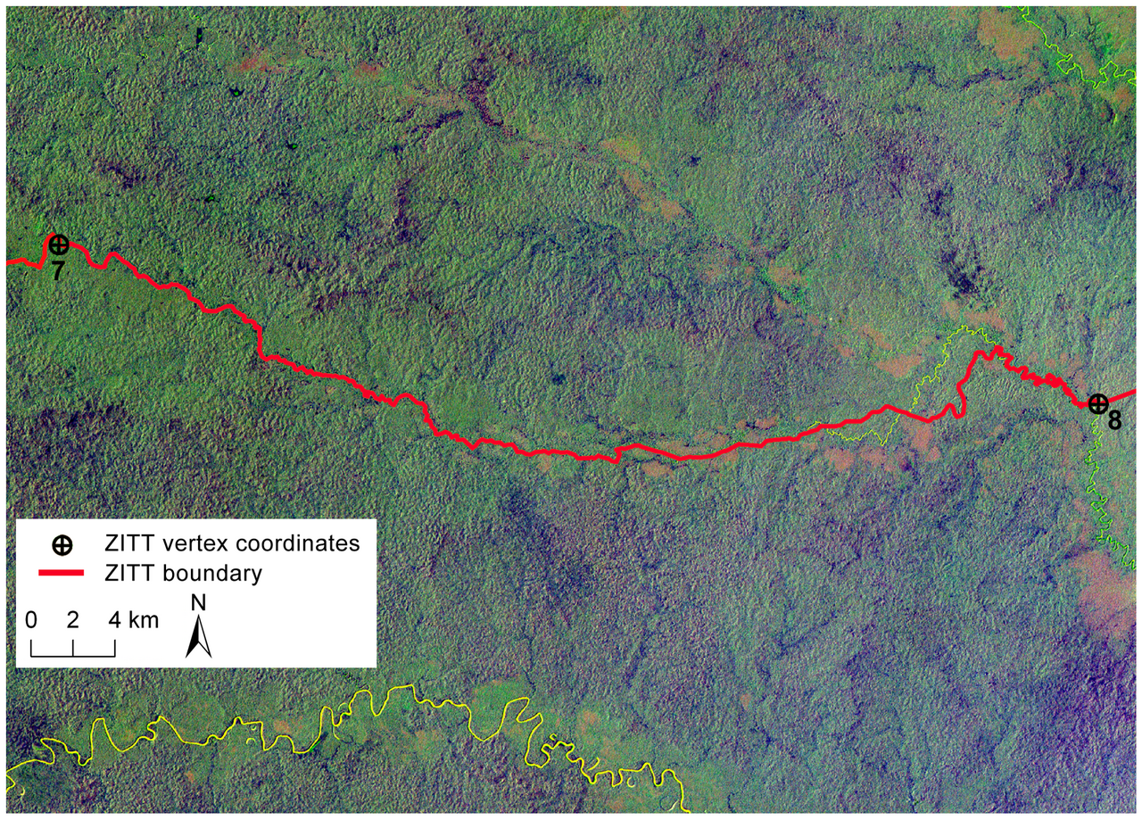
Spatial analysis of perimeter section in the Zona Intangible Tagaeri Taromenane
Summary
[edit]
| Description |
English: Spatial analysis of perimeter section between points No. 7 and No. 8 processing satellite scenes from Landsat TM 5.
Landsat Thematic Mapper (TM) false color composite (4 blue, 5 green, 7 red) of the territory encompassed between points No. 7 and No. 8 in the southern sector of the Oil Block 31 (PetroAmazonas). Boundary section (red color line) does not match the Rio Nashiño river bed (yellow color line). in: Pappalardo SE, De Marchi M, Ferrarese F (2013) Uncontacted Waorani in the Yasuní Biosphere Reserve: Geographical Validation of the Zona Intangible Tagaeri Taromenane (ZITT). PLoS ONE 8(6): e66293. https://doi.org/10.1371/journal.pone.0066293 |
| Date | |
| Source | https://journals.plos.org/plosone/article?id=10.1371/journal.pone.0066293 |
| Author | Salvatore Eugenio Pappalardo, Massimo De Marchi, Francesco Ferrarese |
Licensing
[edit]
This file is licensed under the Creative Commons Attribution-Share Alike 4.0 International license.
- You are free:
- to share – to copy, distribute and transmit the work
- to remix – to adapt the work
- Under the following conditions:
- attribution – You must give appropriate credit, provide a link to the license, and indicate if changes were made. You may do so in any reasonable manner, but not in any way that suggests the licensor endorses you or your use.
- share alike – If you remix, transform, or build upon the material, you must distribute your contributions under the same or compatible license as the original.
File history
Click on a date/time to view the file as it appeared at that time.
| Date/Time | Thumbnail | Dimensions | User | Comment | |
|---|---|---|---|---|---|
| current | 00:05, 10 April 2021 | | 2,065 × 1,482 (7.2 MB) | Scann (talk | contribs) | Uploaded a work by Salvatore Eugenio Pappalardo, Massimo De Marchi, Francesco Ferrarese from https://journals.plos.org/plosone/article?id=10.1371/journal.pone.0066293 with UploadWizard |
You cannot overwrite this file.
File usage on Commons
There are no pages that use this file.