File:Pond, Minet Country Park - geograph.org.uk - 93303.jpg
Jump to navigation
Jump to search
No higher resolution available.
Pond,_Minet_Country_Park_-_geograph.org.uk_-_93303.jpg (640 × 480 pixels, file size: 88 KB, MIME type: image/jpeg)
Captions
Captions
Add a one-line explanation of what this file represents
Summary
[edit]
| Description |
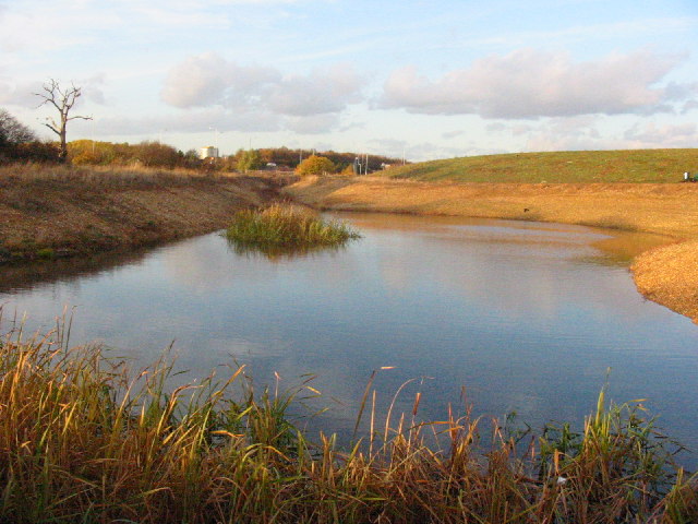
English: Pond, Minet Country Park. The Minet Country Park is newly created from a derelict area used partly as car boot sale, & for motor cycle scrambling. It is now an attractive country park.
Its features include a cycle track, children's playground, lodge, & areas that make it a nature reserve appreciated by many bird species & other wild life. For a "Nature Trail" around the Minet Country Park before and after its creation, see the photographer's web pages: http://ianhday.pwp.blueyonder.co.uk/ |
| Date | |
| Source | From geograph.org.uk |
| Author | Ian Day |
| Attribution (required by the license) | Ian Day / Pond, Minet Country Park / |
| Object location | | View this and other nearby images on: OpenStreetMap |
|---|
_&language=en)
Licensing
[edit]

|
This image was taken from the Geograph project collection. See this photograph's page on the Geograph website for the photographer's contact details. The copyright on this image is owned by Ian Day and is licensed for reuse under the Creative Commons Attribution-ShareAlike 2.0 license.
|
This file is licensed under the Creative Commons Attribution-Share Alike 2.0 Generic license.
Attribution: Ian Day
- You are free:
- to share – to copy, distribute and transmit the work
- to remix – to adapt the work
- Under the following conditions:
- attribution – You must give appropriate credit, provide a link to the license, and indicate if changes were made. You may do so in any reasonable manner, but not in any way that suggests the licensor endorses you or your use.
- share alike – If you remix, transform, or build upon the material, you must distribute your contributions under the same or compatible license as the original.
File history
Click on a date/time to view the file as it appeared at that time.
| Date/Time | Thumbnail | Dimensions | User | Comment | |
|---|---|---|---|---|---|
| current | 00:10, 31 January 2010 | | 640 × 480 (88 KB) | GeographBot (talk | contribs) | == {{int:filedesc}} == {{Information |description={{en|1=Pond, Minet Country Park. The Minet Country Park is newly created from a derelict area used partly as car boot sale, & for motor cycle scrambling. It is now an attractive country park. Its features |
You cannot overwrite this file.
File usage on Commons
There are no pages that use this file.
File usage on other wikis
The following other wikis use this file:
- Usage on en.wikipedia.org