File:Pokesdown, 896 Christchurch Road - geograph.org.uk - 760393.jpg
Jump to navigation
Jump to search
No higher resolution available.
Pokesdown,_896_Christchurch_Road_-_geograph.org.uk_-_760393.jpg (640 × 480 pixels, file size: 75 KB, MIME type: image/jpeg)
Captions
Captions
Add a one-line explanation of what this file represents
Summary
[edit]
| Description |
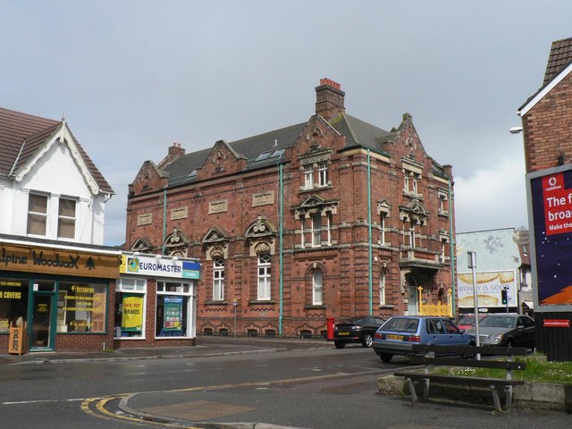
English: Pokesdown: 896 Christchurch Road This imposing building, on the corner of Hannington Road, was the first permanent home of the Bournemouth East School of Science and Art, which had been established in 1892 in rented premises in Drummond Road. The recently founded Education Committee of Bournemouth County Borough Council sought to provide purpose-built premises for the College, and here it is the foundation stone was laid in September 1898 and the building opened twelve months later. At one of its Inspections in 1901, it was recognised as one of few institutions where the teaching of building construction and decorative arts were being correctly conducted.
Today, it is a health centre/clinic, and also houses the 896 Club, a youth club which is named after its address and nicknamed The Numbers. |
| Date | |
| Source | From geograph.org.uk |
| Author | Chris Downer |
| Attribution (required by the license) | Chris Downer / Pokesdown: 896 Christchurch Road / |
| Camera location | | View this and other nearby images on: OpenStreetMap |
|---|
_heading:22.00&language=en)
| Object location | | View this and other nearby images on: OpenStreetMap |
|---|
_heading:22.00&language=en)
Licensing
[edit]

|
This image was taken from the Geograph project collection. See this photograph's page on the Geograph website for the photographer's contact details. The copyright on this image is owned by Chris Downer and is licensed for reuse under the Creative Commons Attribution-ShareAlike 2.0 license.
|
This file is licensed under the Creative Commons Attribution-Share Alike 2.0 Generic license.
Attribution: Chris Downer
- You are free:
- to share – to copy, distribute and transmit the work
- to remix – to adapt the work
- Under the following conditions:
- attribution – You must give appropriate credit, provide a link to the license, and indicate if changes were made. You may do so in any reasonable manner, but not in any way that suggests the licensor endorses you or your use.
- share alike – If you remix, transform, or build upon the material, you must distribute your contributions under the same or compatible license as the original.
File history
Click on a date/time to view the file as it appeared at that time.
| Date/Time | Thumbnail | Dimensions | User | Comment | |
|---|---|---|---|---|---|
| current | 19:15, 19 February 2011 | | 640 × 480 (75 KB) | GeographBot (talk | contribs) | == {{int:filedesc}} == {{Information |description={{en|1=Pokesdown: 896 Christchurch Road This imposing building, on the corner of Hannington Road, was the first permanent home of the Bournemouth East School of Science and Art, which had been established |
You cannot overwrite this file.
File usage on Commons
There are no pages that use this file.
File usage on other wikis
The following other wikis use this file:
- Usage on en.wikipedia.org