File:Poertschach Wörthersee-Rundwanderweg und Bannwaldweg Markierungen 01112014 448.jpg
Jump to navigation
Jump to search

Size of this preview: 800 × 532 pixels. Other resolutions: 320 × 213 pixels | 640 × 426 pixels | 1,024 × 682 pixels | 1,280 × 852 pixels | 2,560 × 1,704 pixels | 4,928 × 3,280 pixels.
Original file (4,928 × 3,280 pixels, file size: 9.58 MB, MIME type: image/jpeg)
Captions
Captions
Add a one-line explanation of what this file represents
Summary
[edit]| Description |
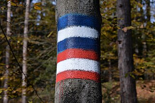
English: Hiking and footpath signs on the autumnal avalanche forest track #8 and the Kaiser Arnulf track at the protected forest, municipality Pörtschach am Wörther See, district Klagenfurt Land, Carinthia, Austria, EU
Deutsch: Wanderweg-Markierungen am herbstlichen Bannwaldweg 8 und am Kaiser Arnulf Weg, Gemeinde Pörtschach am Wörther See, Bezirk Klagenfurt Land, Kärnten, Österreich, EU |
| Date | |
| Source | Own work |
| Author | Johann Jaritz |
| Object location | | View this and other nearby images on: OpenStreetMap |
|---|
Licensing
[edit]Johann Jaritz, the copyright holder of this work, hereby publishes it under the following license:
This file is licensed under the Creative Commons Attribution-Share Alike 4.0 International license.
Attribution: Johann Jaritz / CC BY-SA 4.0
- You are free:
- to share – to copy, distribute and transmit the work
- to remix – to adapt the work
- Under the following conditions:
- attribution – You must give appropriate credit, provide a link to the license, and indicate if changes were made. You may do so in any reasonable manner, but not in any way that suggests the licensor endorses you or your use.
- share alike – If you remix, transform, or build upon the material, you must distribute your contributions under the same or compatible license as the original.
Modifications
[edit]|
|
Please do not upload a modified image here without consultation with the Author. The author would like to make corrections only at his own source. This ensures that the changes are preserved. |

| Annotations | This image is annotated: View the annotations at Commons |
File history
Click on a date/time to view the file as it appeared at that time.
| Date/Time | Thumbnail | Dimensions | User | Comment | |
|---|---|---|---|---|---|
| current | 16:07, 2 November 2014 | | 4,928 × 3,280 (9.58 MB) | Johann Jaritz (talk | contribs) | {{Information |Description={{en|1=Hiking and footpath signs on the autumnal avalanche forest track #8 and the Kaiser Arnulf track at the protected forest, municipality Poertschach on the Lake Woerth, district Klagenfur... |
You cannot overwrite this file.
File usage on Commons
The following 2 pages use this file: