File:Podhradí-Lichnice, CZ170325-236.jpg
Jump to navigation
Jump to search

Size of this preview: 800 × 450 pixels. Other resolutions: 320 × 180 pixels | 640 × 360 pixels | 1,024 × 576 pixels | 1,280 × 719 pixels | 2,560 × 1,439 pixels | 4,896 × 2,752 pixels.
Original file (4,896 × 2,752 pixels, file size: 4.23 MB, MIME type: image/jpeg)
Captions
Captions
Add a one-line explanation of what this file represents
Summary
[edit]
| Description |
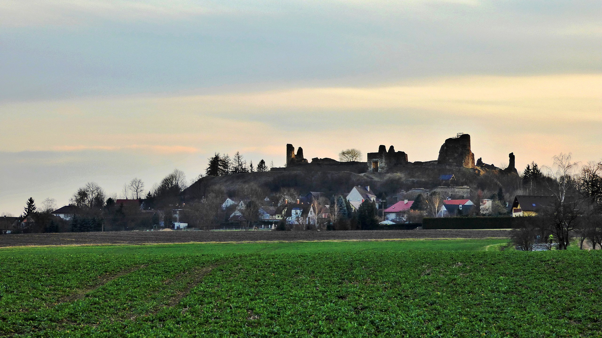
English: "Lichnice", castle ruin. View from "Rudov" in the spring early evening. Originally Lichtenberk Castle, later with of the Czech name Lichnice, lies on the Podhradí cadastral area in the Iron Mountains in the Chrudim district belonging to the Pardubice Region. The landscape of the Podhrad basins in the "Sečska" highlands, part of the geomorphological whole of the Železné hory. Note: Above the former castle tower, in the photo-shot on the right, see part of the observation platform of the lookout tower named Milada, according to the legend bound to the original castle. Photo location: Czechia, Pardubice Region, villages Podhradí
Čeština: Lichnice, hradní zřícenina. Pohled od Rudova v jarním podvečeru. Původně hrad Lichtenberk, později s počeštěným názvem Lichnice, leží na katastru Podhradí v Železných horách v okrese Chrudim náležejícím do Pardubického kraje. Krajina Podhradské kotliny v Sečské vrchovině, součást geomorfologického celku Železné hory. Nad bývalou hradní věží, ve foto-záběru vpravo, vidět část vyhlídkové plošiny rozhledny pojmenované Milada, podle pověsti vázající se k původnímu hradu. Foto lokace: Česko, Pardubický kraj, Podhradí. |
| Date | |
| Source | Own work |
| Author | Josef Kreuz (PEPan) |
| Camera location | | View this and other nearby images on: OpenStreetMap |
|---|
Poznámka
[edit]
Slavnostně otevřena veřejnosti dne 22. května 2017 a pojmenovaná Milada, podle legendy spojené s původním hradem, též uváděna jako Lichnická rozhledna nebo rozhledna Lichnice.
Externí odkazy
[edit]
- Turistická mapa Česka – kompozice hradní zřícenina Lichnice
- Třemošnice, turistické informační centrum – Lichnice, hradní zřícenina
Licensing
[edit]
I, the copyright holder of this work, hereby publish it under the following license:
This file is licensed under the Creative Commons Attribution-Share Alike 4.0 International license.
- You are free:
- to share – to copy, distribute and transmit the work
- to remix – to adapt the work
- Under the following conditions:
- attribution – You must give appropriate credit, provide a link to the license, and indicate if changes were made. You may do so in any reasonable manner, but not in any way that suggests the licensor endorses you or your use.
- share alike – If you remix, transform, or build upon the material, you must distribute your contributions under the same or compatible license as the original.
File history
Click on a date/time to view the file as it appeared at that time.
| Date/Time | Thumbnail | Dimensions | User | Comment | |
|---|---|---|---|---|---|
| current | 12:15, 6 August 2017 | | 4,896 × 2,752 (4.23 MB) | PEPan (talk | contribs) | User created page with UploadWizard |
You cannot overwrite this file.
File usage on Commons
There are no pages that use this file.
File usage on other wikis
The following other wikis use this file:
- Usage on cs.wikipedia.org