File:Podebrady detail III. mapovani.JPG
Jump to navigation
Jump to search
Size of this preview: 800 × 522 pixels. Other resolutions: 320 × 209 pixels | 640 × 418 pixels | 824 × 538 pixels.
Original file (824 × 538 pixels, file size: 392 KB, MIME type: image/jpeg)
Captions
Captions
Add a one-line explanation of what this file represents
Summary
[edit]
| Description |
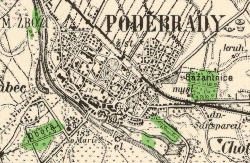
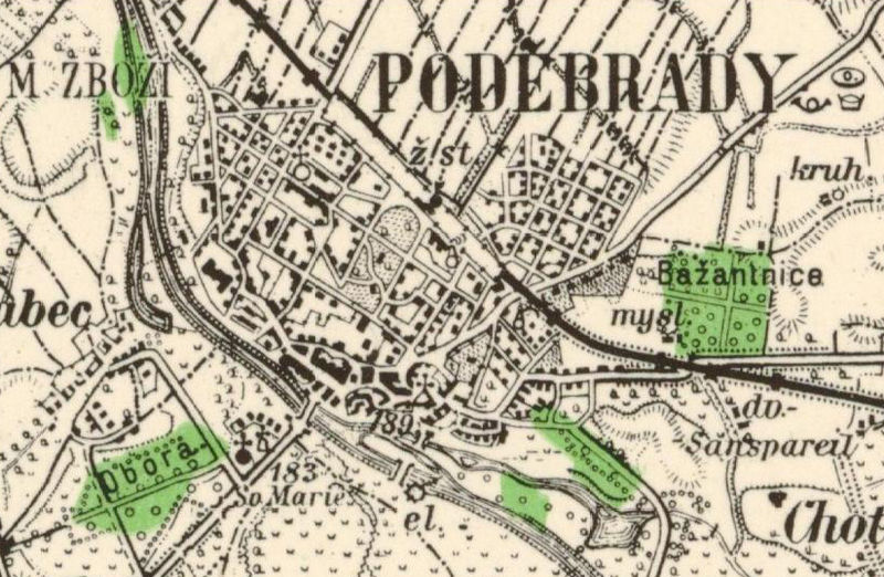
English: The map of Poděbrady from the Third Military Mapping Survey of Austria Empire
Čeština: Mapa centra Poděbrad z Třetího vojenského mapování |
| Date | between 1868 and 1880 |
| Source | http://oldmaps.geolab.cz/ |
| Author |
|
Licensing
[edit]
|
This work is in the public domain in its country of origin and other countries and areas where the copyright term is the author's life plus 70 years or fewer. | |
| This file has been identified as being free of known restrictions under copyright law, including all related and neighboring rights. | |
File history
Click on a date/time to view the file as it appeared at that time.
| Date/Time | Thumbnail | Dimensions | User | Comment | |
|---|---|---|---|---|---|
| current | 16:04, 10 July 2009 | | 824 × 538 (392 KB) | Nadkachna (talk | contribs) | {{Information |Description={{en|1=The map of Poděbrady from the Third Military Mapping Survey of Austria Empire}} {{cs|1=Mapa centra Poděbrad z Třetího vojenského mapování}} |Source=http://oldmaps.geolab.cz/ |Author=*Original source: http://oldmaps |
You cannot overwrite this file.
File usage on Commons
There are no pages that use this file.
File usage on other wikis
The following other wikis use this file:
- Usage on cs.wikipedia.org