File:Plumpton Racecourse - geograph.org.uk - 1507837.jpg
Jump to navigation
Jump to search
No higher resolution available.
Plumpton_Racecourse_-_geograph.org.uk_-_1507837.jpg (640 × 480 pixels, file size: 37 KB, MIME type: image/jpeg)
Captions
Captions
Add a one-line explanation of what this file represents
Summary
[edit]
| Description |
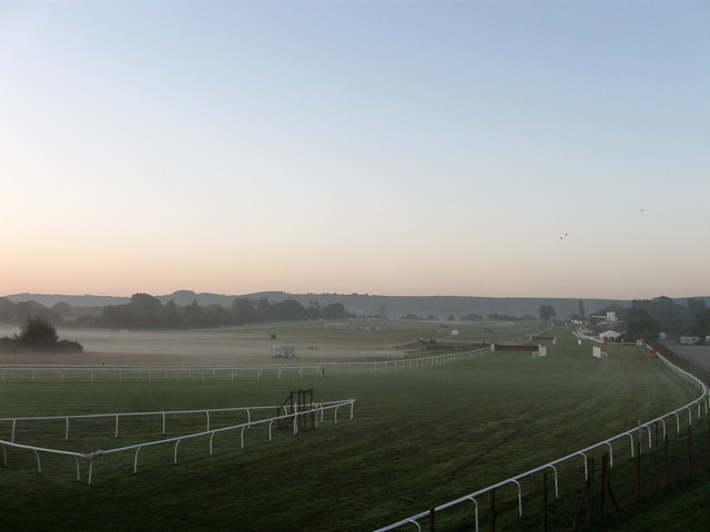
English: Plumpton Racecourse Viewed from the footbridge over the railway. The northern end of the course falls in this square with the rest in TQ3615. The course was opened in 1884 on farmland formerly owned by nearby Ashurst Farm utilising the recently opened Plumpton station. The steeplechases were introduced in 1892. An early morning mist envelopes the northern part of the course but thins out towards the southern end where the northern scarp slope of the South Downs can be seen on the horizon. |
| Date | |
| Source | From geograph.org.uk |
| Author | Simon Carey |
| Attribution (required by the license) | Simon Carey / Plumpton Racecourse / |
| Camera location | | View this and other nearby images on: OpenStreetMap |
|---|
_heading:180.00&language=en)
| Object location | | View this and other nearby images on: OpenStreetMap |
|---|
_heading:180.00&language=en)
Licensing
[edit]

|
This image was taken from the Geograph project collection. See this photograph's page on the Geograph website for the photographer's contact details. The copyright on this image is owned by Simon Carey and is licensed for reuse under the Creative Commons Attribution-ShareAlike 2.0 license.
|
This file is licensed under the Creative Commons Attribution-Share Alike 2.0 Generic license.
Attribution: Simon Carey
- You are free:
- to share – to copy, distribute and transmit the work
- to remix – to adapt the work
- Under the following conditions:
- attribution – You must give appropriate credit, provide a link to the license, and indicate if changes were made. You may do so in any reasonable manner, but not in any way that suggests the licensor endorses you or your use.
- share alike – If you remix, transform, or build upon the material, you must distribute your contributions under the same or compatible license as the original.
File history
Click on a date/time to view the file as it appeared at that time.
| Date/Time | Thumbnail | Dimensions | User | Comment | |
|---|---|---|---|---|---|
| current | 21:23, 2 March 2011 | | 640 × 480 (37 KB) | GeographBot (talk | contribs) | == {{int:filedesc}} == {{Information |description={{en|1=Plumpton Racecourse Viewed from the footbridge over the railway. The northern end of the course falls in this square with the rest in TQ3615. The course was opened in 1884 on farmland formerly owned |
You cannot overwrite this file.
File usage on Commons
There are no pages that use this file.