File:PlantMapper distribution map for Dittrichia graveolens (Stinkwort) in California, by County.jpg
Jump to navigation
Jump to search

Size of this preview: 600 × 600 pixels. Other resolutions: 240 × 240 pixels | 480 × 480 pixels | 768 × 768 pixels | 1,024 × 1,024 pixels | 1,500 × 1,500 pixels.
Original file (1,500 × 1,500 pixels, file size: 156 KB, MIME type: image/jpeg)
Captions
Captions
Add a one-line explanation of what this file represents
Summary
[edit]_in_California,_by_County.jpg&action=edit§ion=1)
| Description |
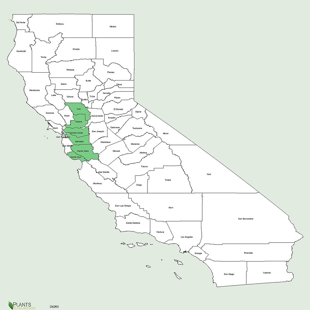
English: PlantMapper distribution map for Dittrichia graveolens (Stinkwort) in California, by County, showing 6 counties it is present in: Yolo, Solano, Contra Costa, Alameda, Santa Clara, Santa Cruz. Generated by Plantsdatabase at USDA PLANTS Profile website |
| Date | |
| Source | http://plants.usda.gov/java/county?state_name=California&statefips=06&symbol=DIGR3 |
| Author | U. S. Department of Agriculture. |
Licensing
[edit]_in_California,_by_County.jpg&action=edit§ion=2)
This image or file is a work of a United States Department of Agriculture employee, taken or made as part of that person's official duties. As a work of the U.S. federal government, the image is in the public domain.
|
 |
File history
Click on a date/time to view the file as it appeared at that time.
| Date/Time | Thumbnail | Dimensions | User | Comment | |
|---|---|---|---|---|---|
| current | 06:25, 14 August 2013 | | 1,500 × 1,500 (156 KB) | Mercurywoodrose (talk | contribs) | User created page with UploadWizard |
You cannot overwrite this file.
File usage on Commons
There are no pages that use this file.
File usage on other wikis
The following other wikis use this file:
- Usage on cy.wikipedia.org
_in_California,_by_County.jpg&oldid=912904656)