File:Plans van het geprojecteerde fort van Soeracarta (Soerakarta, Surakarta).jpg
Original file (2,212 × 1,599 pixels, file size: 557 KB, MIME type: image/jpeg)
Captions
Captions
Summary
[edit]| Description |
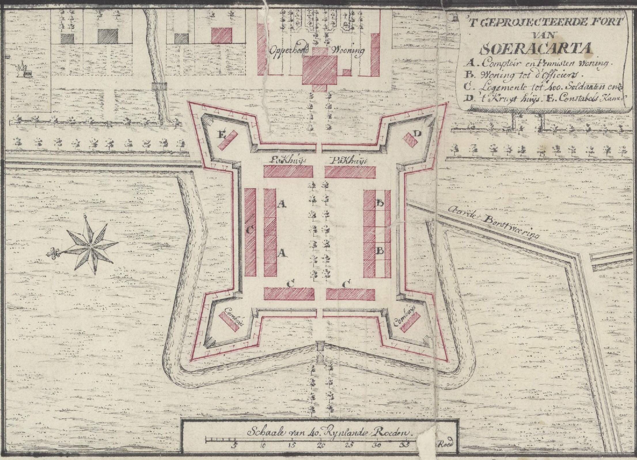
Nederlands: 492 - Kaart van een gedeelte van Midden-Java, tusschen de rivieren Indermaya en Calliwongo aan de noordkust en Calitondo en Oempar aan de zuidkust, met plans van het "geprojecteerde fort van Soeracarta", "Salatiga", "Samarang sooals het staat in het jaar 1756", "Paccalongang gebouwt in het jaar 1753" en Tagal gebouwt in het jaar 1754". |
||||
| Date | |||||
| Source | https://www.nationaalarchief.nl/onderzoeken/kaartencollectie/NL-HaNA_4.VELH_492?searchKey=c3d93ac555a430062d19a69662abf8a4 | ||||
| Author | Unknown author | ||||
| Permission (Reusing this file) |
|
||||
| Other versions | |||||

.jpg&action=edit§ion=1)
Licensing
[edit].jpg&action=edit§ion=2)
|
This work is in the public domain in its country of origin and other countries and areas where the copyright term is the author's life plus 70 years or fewer.
| |
| This file has been identified as being free of known restrictions under copyright law, including all related and neighboring rights. | |
File history
Click on a date/time to view the file as it appeared at that time.
| Date/Time | Thumbnail | Dimensions | User | Comment | |
|---|---|---|---|---|---|
| current | 09:42, 24 October 2022 | | 2,212 × 1,599 (557 KB) | Bennylin (talk | contribs) | File:Kaart van een gedeelte van Midden-Java, tusschen de rivieren Indermaya en Calliwongo aan de noordkust en Calitondo en Oempar aan de zuidkust, fort van Soeracarta, Salatiga, Samarang, Paccalongang, en Tagal.jpg cropped 68 % horizontally, 84 % vertically using CropTool with precise mode. |
You cannot overwrite this file.
File usage on Commons
The following page uses this file:
File usage on other wikis
The following other wikis use this file:
- Usage on id.wikipedia.org
.jpg&oldid=698786068)