File:Plano de Pto. Rico en la ysla de este nombre situado en 18037ʹ de latitd. N. y en 59042ʹ de longd. O. de Cádiz -.jpg
Jump to navigation
Jump to search
Size of this preview: 800 × 583 pixels. Other resolutions: 320 × 233 pixels | 640 × 466 pixels | 1,024 × 746 pixels | 1,280 × 933 pixels | 1,559 × 1,136 pixels.
Original file (1,559 × 1,136 pixels, file size: 285 KB, MIME type: image/jpeg)
Captions
Captions
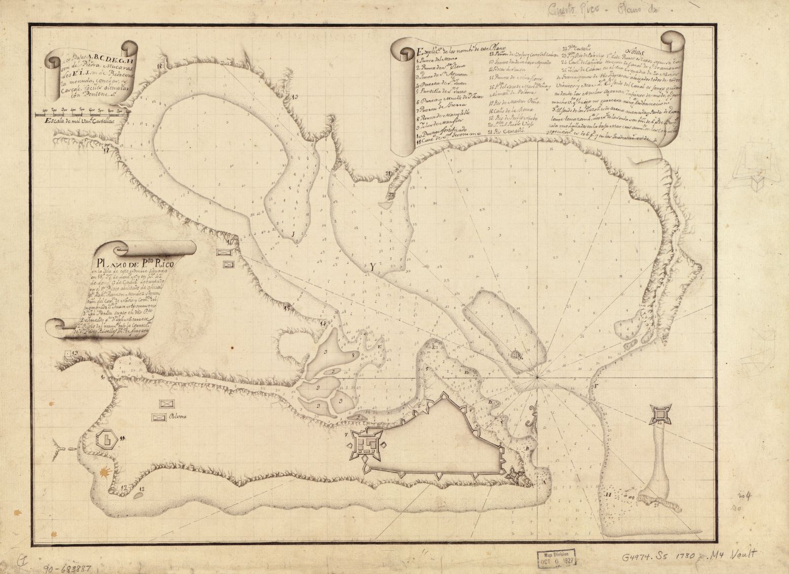
Manuscript map of San Juan, Puerto Rico, circa 1780
Summary
[edit]| Title |
Español: Plano de Pto. Rico en la ysla de este nombre situado en 18⁰37ʹ de latitd. N. y en 59⁰42ʹ de longd. O. de Cádiz English: Map of Puerto Rico on the island of the same name ... |
|||||||||||||||||||||||
| Description |
Manuscript, pen-and-ink |
|||||||||||||||||||||||
| Date | circa 1780 | |||||||||||||||||||||||
| Source | https://www.loc.gov/item/90683887/ | |||||||||||||||||||||||
| Creator |
Francisco Ramón Méndez Joseph Navarrete |
|||||||||||||||||||||||
| Geotemporal data | ||||||||||||||||||||||||
| Map location | San Juan, Puerto Rico | |||||||||||||||||||||||
| Heading |
 |
|||||||||||||||||||||||
| Bibliographic data | ||||||||||||||||||||||||
| Language | Spanish | |||||||||||||||||||||||
| Archival data | ||||||||||||||||||||||||
| Collection |
|
|||||||||||||||||||||||
| Accession number |
G4974.S5 1780 .M4 |
|||||||||||||||||||||||
| Dimensions | height: 34 cm (13.3 in); width: 45 cm (17.7 in) | |||||||||||||||||||||||
| Notes |
- LC Luso-Hispanic World, 767 - Available also through the Library of Congress Web site as a raster image. - Maggs number annotated in pencil in lower right margin: 4. |
|||||||||||||||||||||||

Licensing
[edit]
|
This work is in the public domain in its country of origin and other countries and areas where the copyright term is the author's life plus 100 years or fewer. | |
| This file has been identified as being free of known restrictions under copyright law, including all related and neighboring rights. | |
File history
Click on a date/time to view the file as it appeared at that time.
| Date/Time | Thumbnail | Dimensions | User | Comment | |
|---|---|---|---|---|---|
| current | 07:42, 14 December 2015 | | 1,559 × 1,136 (285 KB) | Caballero1967 (talk | contribs) | User created page with UploadWizard |
You cannot overwrite this file.
File usage on Commons
The following page uses this file: