File:Planned detention basins on Tagliamento.png
Jump to navigation
Jump to search
Size of this preview: 366 × 598 pixels. Other resolutions: 147 × 240 pixels | 293 × 480 pixels | 470 × 768 pixels | 626 × 1,024 pixels | 1,578 × 2,580 pixels.
Original file (1,578 × 2,580 pixels, file size: 4.75 MB, MIME type: image/png)
Captions
Captions
Add a one-line explanation of what this file represents
| Description |
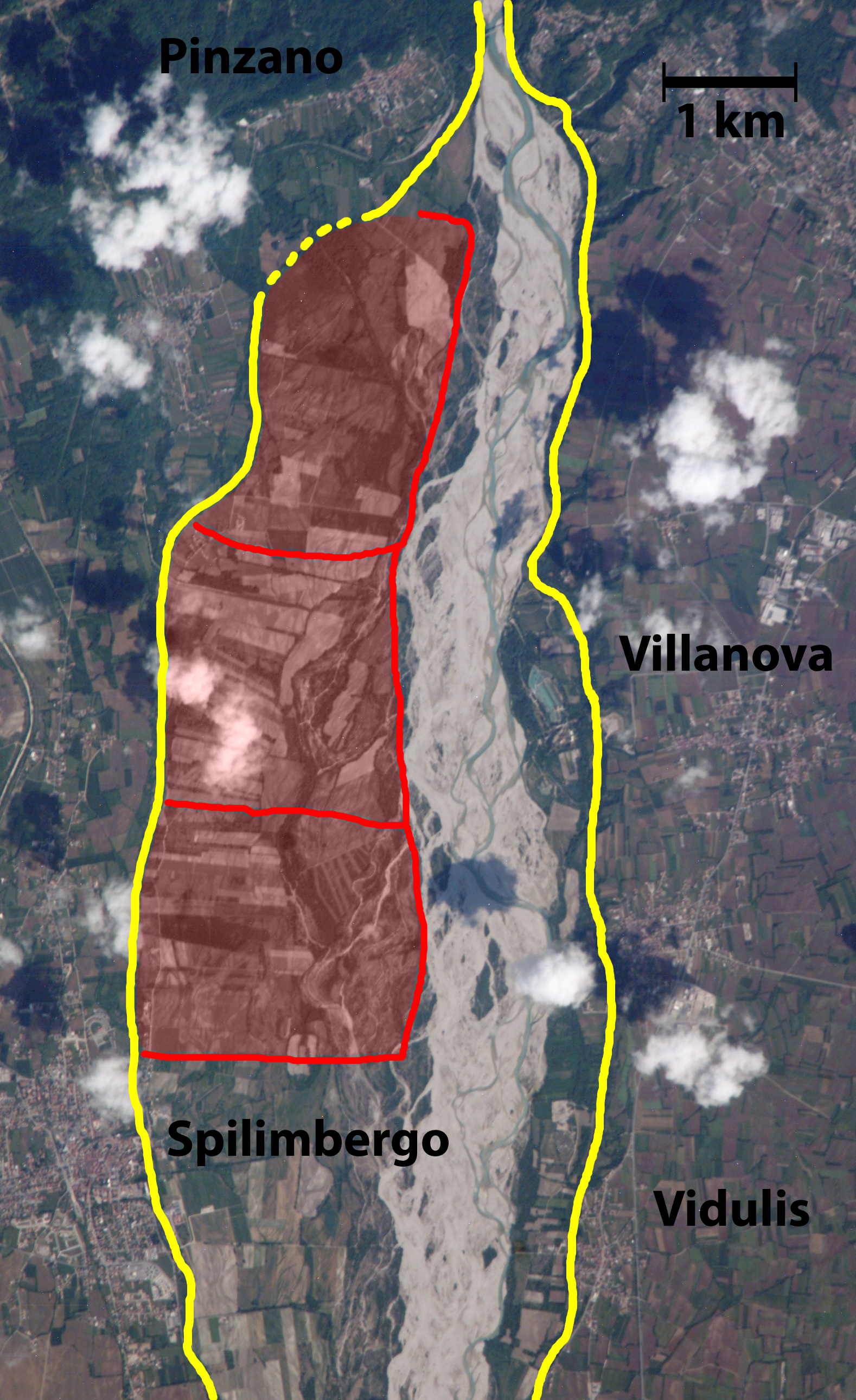
English: Planned detention basins on Tagliamento river between Pinzano and Dignano, northeast Italy. Yellow lines = natural levees. Red lines = perimeters of the basins. Italiano: Sito pianificato delle casse di espansione sul fiume Tagliamento fra Pinzano e Dignano, nordest Italia. Linee gialle = argini naturali. Linee rosse = perimetri delle casse |
| Date | (UTC) |
| Source | |
| Author |
|
| This is a retouched picture, which means that it has been digitally altered from its original version. The original can be viewed here: Tagliamento between Pinzano and Dignano.JPG:
|
| This file is in the public domain in the United States because it was solely created by NASA. NASA copyright policy states that "NASA material is not protected by copyright unless noted". (See Template:PD-USGov, NASA copyright policy page or JPL Image Use Policy.) | ||
 |
Warnings:
|
Original upload log
[edit]
This image is a derivative work of the following images:
- File:Tagliamento_between_Pinzano_and_Dignano.JPG licensed with PD-USGov-NASA
- 2010-10-27T18:20:26Z Diego Cruciat 3032x2064 (1284621 Bytes) {{Information |Description={{en|1=Tagliamento river between Pinzano and Dignano, northeast Italy, }} {{it|1=Il fiume Tagliamento fra Pinzano e Dignano, nordest Italia}} |Source=http://earth.jsc.nasa.gov/scripts/sseop/QuickVie
Uploaded with derivativeFX
File history
Click on a date/time to view the file as it appeared at that time.
| Date/Time | Thumbnail | Dimensions | User | Comment | |
|---|---|---|---|---|---|
| current | 20:49, 27 October 2010 | | 1,578 × 2,580 (4.75 MB) | Diego Cruciat (talk | contribs) | {{Information |Description={{en|1=Planned detention basins on Tagliamento river between Pinzano and Dignano, northeast Italy, }} {{it|1=Sito pianificato delle casse di espansione sul fiume Tagliamento fra Pinzano e Dignano, nordest Italia}} |Source=*[[:Fi |
You cannot overwrite this file.
File usage on Commons
There are no pages that use this file.
File usage on other wikis
The following other wikis use this file:
- Usage on de.wikipedia.org
- Usage on it.wikipedia.org
- Usage on sl.wikipedia.org