File:Plana del Rosselló 2013 07 25 01 IR M8.jpg
Jump to navigation
Jump to search

Size of this preview: 800 × 113 pixels. Other resolutions: 320 × 45 pixels | 640 × 90 pixels | 1,024 × 145 pixels | 1,280 × 181 pixels | 2,560 × 362 pixels | 17,257 × 2,437 pixels.
Original file (17,257 × 2,437 pixels, file size: 14.8 MB, MIME type: image/jpeg)
Captions
Captions
Add a one-line explanation of what this file represents
Summary
[edit]
| Description |
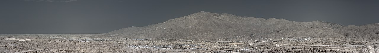
Français : Plaine du Roussillon et les Albères depuis l'ermitage Saint-Ferreol, Céret (Pyrénées-Orientales, Languedoc-Roussillon, France) photographiée avec un filtre infrarouge 720 nm.
Català: Plana del Rosselló i l'Albera des del des de l'ermita Sant Ferriol, Ceret (Pirineus Orientals, Llenguadoc-Rosselló, França) fotografiadat amb un filtre infraroig 720 nm.
Español: Llanura del Rossellón i la Albera desde la ermita de San Ferreol, Céret (Pirineos Orientales, Languedoc-Rosellón, Francia)} fotografiada con un filtro infrarrojo 720 nm.
This image was created with Hugin. This image was created with Qtpfsgui. Luminance HDR 2.3.0 tonemapping parameters:
Parameters:
PreGamma: 0.88 |
| Date | |
| Source | Own work |
| Author |
Bertrand GRONDIN |
| Camera location | | View this and other nearby images on: OpenStreetMap |
|---|
| Object location | | View this and other nearby images on: OpenStreetMap |
|---|
Licensing
[edit]
I, the copyright holder of this work, hereby publish it under the following licenses:

|
Permission is granted to copy, distribute and/or modify this document under the terms of the GNU Free Documentation License, Version 1.2 or any later version published by the Free Software Foundation; with no Invariant Sections, no Front-Cover Texts, and no Back-Cover Texts. A copy of the license is included in the section entitled GNU Free Documentation License. |
This file is licensed under the Creative Commons Attribution-Share Alike 3.0 Unported, 2.5 Generic, 2.0 Generic and 1.0 Generic license.
- You are free:
- to share – to copy, distribute and transmit the work
- to remix – to adapt the work
- Under the following conditions:
- attribution – You must give appropriate credit, provide a link to the license, and indicate if changes were made. You may do so in any reasonable manner, but not in any way that suggests the licensor endorses you or your use.
- share alike – If you remix, transform, or build upon the material, you must distribute your contributions under the same or compatible license as the original.
You may select the license of your choice.
File history
Click on a date/time to view the file as it appeared at that time.
| Date/Time | Thumbnail | Dimensions | User | Comment | |
|---|---|---|---|---|---|
| current | 20:32, 16 October 2013 | 17,257 × 2,437 (14.8 MB) | Grondin (talk | contribs) | {{Information |Description ={{fr|1=Plaine du Roussillon et les Albères depuis l'ermitage Saint-Ferreol, Céret (Pyrénées-Orientales, Languedoc-Roussillon, France) photographiée avec un filtre infrarouge 720 nm.}} {{ca|1=Plana del Rosselló i l'A... |
You cannot overwrite this file.
File usage on Commons
There are no pages that use this file.
File usage on other wikis
The following other wikis use this file:
- Usage on ca.wikipedia.org