File:Plan stolichnago goroda Sanktpeterburga c izobrazhenïem znashni︠e︡ĭshikh onago prospektov LOC 14002124-5.jpg
Jump to navigation
Jump to search

Size of this preview: 800 × 527 pixels. Other resolutions: 320 × 211 pixels | 640 × 421 pixels | 1,024 × 674 pixels | 1,280 × 843 pixels | 2,560 × 1,686 pixels | 11,424 × 7,522 pixels.
Original file (11,424 × 7,522 pixels, file size: 6.12 MB, MIME type: image/jpeg)
Captions
Captions
Add a one-line explanation of what this file represents
Summary
[edit]| Warning | The original file is very high-resolution. It might not load properly or could cause your browser to freeze when opened at full size. |
|---|
| Description |
English: Available also through the Library of Congress Web site as a raster image. Index in Russian, romanized Russian, and French. English translation of French map captions: 1. Map of St. Petersburg from 1737 -- 2. View of the Neva towards the East between the shipyards and the 13th line of the Wasily section -- 3. View of the banks of the Neva showing the river between the Admiralty and the buildings of the Academy of Sciences -- 4. View of the banks of the Neva downriver between the Winter Palace and the buildings of the Academy of Sciences -- 5. View of the Neva towards the West between the Church of St. Isaac and the buildings of the Cadet Corps -- 6. View of the Fontancka River towards the south between the grotto and the court's storehouses -- 7. View of the Admiralty and its surroundings looking west from the triumphal arch -- 8. View of a part of the town of St. Petersburg looking east from the triumphal arch -- 9. View of the Bourse and the commodities market while ascending from the little Neva -- 10. View of the buildings of the Imperial Colleges and a part of the commodities market toward the east -- 11. View of the New Palace from the triumphal arch of Anitschki toward the east with a part of the town and Nevsky Prospect close to the shore of the Fontanka -- 12. View of the Summer Palace from the north shore -- 13. View of the Old Winter Palace and the canal that joins the Moika and the Neva -- 14. View of Kamennoy Island on the little Newka near the St. Petersburg residence of the Countess Bestoucheff Rumin -- 15. Map of Moscow from 1739. Includes index. |
||
| Title | Plan stolichnago goroda Sanktpeterburga c izobrazhenïem znashni︠e︡ĭshikh onago prospektov | ||
| Shelf ID | G2114.L4 A3 1753 | ||
| Parent | https://www.loc.gov/resource/g7064lm.gct00144/ | ||
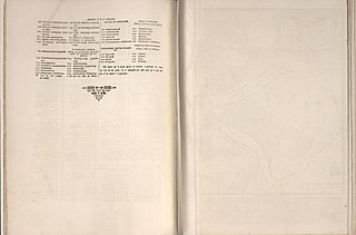
| Sheet title | Table of contents, p.6 | ||
| Date | |||
| Source | https://www.loc.gov/item/14002124/ | ||
| Author | Imperatorskai︠A︡ Akademīi︠A︡ Nauk I Khudozhestv (Russia); Valeriani, Giuseppe; Makhaev, Mikhail Ivanovich; Sokolov, Ivan Aleksi︠E︡Evich; Treskot, Johann | ||
| Permission (Reusing this file) |
|
||
| Other versions |
|
||
| Location | Saint Petersburg · Moscow · Russia · St. Petersburg | ||
| Part of | American Memory · Cities And Towns · Catalog · Geography And Map Division | ||
| Subject | Moscow (Russia) · Aerial Views · Moscow · St. Petersburg · Maps · Early Works To 1800 · Saint Petersburg (Russia) · Russia |


Licensing
[edit]
|
This is a faithful photographic reproduction of a two-dimensional, public domain work of art. The work of art itself is in the public domain for the following reason:
The official position taken by the Wikimedia Foundation is that "faithful reproductions of two-dimensional public domain works of art are public domain".
This photographic reproduction is therefore also considered to be in the public domain in the United States. In other jurisdictions, re-use of this content may be restricted; see Reuse of PD-Art photographs for details. | ||||
File history
Click on a date/time to view the file as it appeared at that time.
| Date/Time | Thumbnail | Dimensions | User | Comment | |
|---|---|---|---|---|---|
| current | 14:15, 20 July 2018 | | 11,424 × 7,522 (6.12 MB) | Fæ (talk | contribs) | LOC Maps multisheet https://www.loc.gov/item/14002124/ sheet 5 of 20 #212 |
You cannot overwrite this file.
File usage on Commons
The following 2 pages use this file: