File:Plan of Fort Pownal at Penobscot.jpg
Original file (1,184 × 898 pixels, file size: 156 KB, MIME type: image/jpeg)
Captions
Captions
| Description |
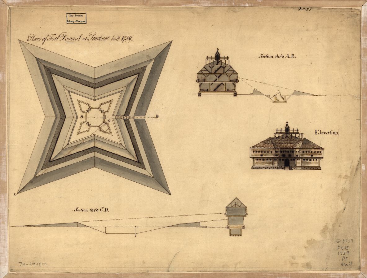
English: Plan of Fort Pownall at Penobscot built 1759. Col. map 37 x 48 cm. Includes 3 profile views. Manuscript, pen-and-ink and watercolor. Library of Congress Geography and Map Division. |
||||
| Date | |||||
| Source |
https://www.loc.gov/resource/g3734f.ar083700/
|
||||
| Author | Watermark: J. Whatman | ||||
| Permission (Reusing this file) |
|
||||

File history
Click on a date/time to view the file as it appeared at that time.
| Date/Time | Thumbnail | Dimensions | User | Comment | |
|---|---|---|---|---|---|
| current | 00:37, 27 June 2017 | | 1,184 × 898 (156 KB) | Taterian (talk | contribs) | Transferred from http://tile.loc.gov/image-services/iiif/service:gmd:gmd373:g3734:g3734f:ar083700/full/pct:25/0/default.jpg |
You cannot overwrite this file.
File usage on Commons
There are no pages that use this file.