File:Plan du canal qui sépare l'Ile de Rugen de la Poméranie - levé par ordre de M. Daugier, Colonel des marins de la Garde Impériale - par M.M. Etchégaray et Thanaron , Lieutenants de Vaisseau ; dressé et dessiné... - btv1b532009687.jpg
Jump to navigation
Jump to search

Size of this preview: 800 × 492 pixels. Other resolutions: 320 × 197 pixels | 640 × 393 pixels | 1,024 × 630 pixels | 1,280 × 787 pixels | 2,560 × 1,574 pixels | 11,386 × 7,000 pixels.
Original file (11,386 × 7,000 pixels, file size: 5.86 MB, MIME type: image/jpeg)
Captions
Captions
Add a one-line explanation of what this file represents
Summary
[edit]| Warning | The original file is very high-resolution. It might not load properly or could cause your browser to freeze when opened at full size. |
|---|
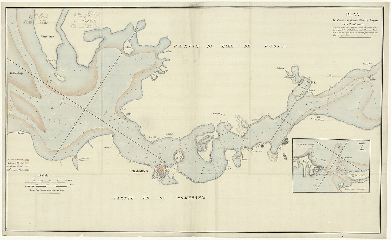
| Plan du canal qui sépare l'Ile de Rugen de la Poméranie : levé par ordre de M. Daugier, Colonel des marins de la Garde Impériale / par M.M. Etchégaray et Thanaron , Lieutenants de Vaisseau ; dressé et dessiné par Cudorge Désir, Fourrier
( |
|||||||||||||||||||||||||||
|---|---|---|---|---|---|---|---|---|---|---|---|---|---|---|---|---|---|---|---|---|---|---|---|---|---|---|---|
| Author |
Etchégaray, Michel (1773-1829). Cartographe Thanaron, Pierre Paul Pascal (1773-1861). Cartographe |
||||||||||||||||||||||||||
| Title |
Plan du canal qui sépare l'Ile de Rugen de la Poméranie : levé par ordre de M. Daugier, Colonel des marins de la Garde Impériale / par M.M. Etchégaray et Thanaron , Lieutenants de Vaisseau ; dressé et dessiné par Cudorge Désir, Fourrier |
||||||||||||||||||||||||||
| Description |
Français : Sujet : Rügen, Île de
Poméranie, Duché de Échelle(s) : [Echelle à calculer] Couverture : Mer Baltique Langue : français |
||||||||||||||||||||||||||
| Date | 1809 | ||||||||||||||||||||||||||
| Dimensions | height: 96 cm (37.7 in); width: 59 cm (23.2 in) | ||||||||||||||||||||||||||
| Collection |
|
||||||||||||||||||||||||||
| References |
Français : Notice de recueil : http://catalogue.bnf.fr/ark:/12148/cb422253116
Appartient à : [Division 2 du portefeuille 11 du Service hydrographique de la marine consacrée à Stralsund, Allemagne] ; 2 (2) Notice du catalogue : http://catalogue.bnf.fr/ark:/12148/cb45803804v |
||||||||||||||||||||||||||
| Source/Photographer |
Français : Bibliothèque nationale de France, département Cartes et plans, GE SH 19 PF 11 DIV 2 P 2 (2)
Bibliothèque nationale de France |
||||||||||||||||||||||||||
| Permission (Reusing this file) |
|
||||||||||||||||||||||||||

File history
Click on a date/time to view the file as it appeared at that time.
| Date/Time | Thumbnail | Dimensions | User | Comment | |
|---|---|---|---|---|---|
| current | 14:00, 26 July 2022 | | 11,386 × 7,000 (5.86 MB) | Gzen92Bot (talk | contribs) | Gallica btv1b532009687 |
You cannot overwrite this file.
File usage on Commons
The following page uses this file: