File:Plan de la place de Corfù avec ses environs assiegee par... - CBT 5883767.jpg
Jump to navigation
Jump to search

Size of this preview: 692 × 600 pixels. Other resolutions: 277 × 240 pixels | 554 × 480 pixels | 887 × 768 pixels | 1,182 × 1,024 pixels | 2,364 × 2,048 pixels | 5,508 × 4,772 pixels.
Original file (5,508 × 4,772 pixels, file size: 8.93 MB, MIME type: image/jpeg)
Captions
Captions
Add a one-line explanation of what this file represents
Summary
[edit]| Title |
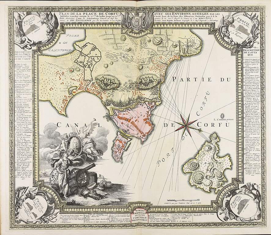
Plan de la place de Corfù avec ses environs assiegee par les infideles tranchee ouverte le 25me de Iuillet jusqu'au 22me d'Aout iour de la fuite des Ottomans defendüe par S.E. le feldt. marechal comte de Schulembourg general en chef des armées de la ser.m |
|||||||||||||||||||||||
| Date | circa 1716 | |||||||||||||||||||||||
| Source |
|
|||||||||||||||||||||||
| Creator |
|
|||||||||||||||||||||||
| Permission (Reusing this file) |
|
|||||||||||||||||||||||
| Georeferencing | If inappropriate please set warp_status = skip to hide. | |||||||||||||||||||||||
| Bibliographic data | ||||||||||||||||||||||||
| Publisher |
|
|||||||||||||||||||||||
| Archival data | ||||||||||||||||||||||||
| Collection |
|
|||||||||||||||||||||||
| Accession number |
|
|||||||||||||||||||||||
| Dimensions | 1 c. geogr. 483x562 mm | |||||||||||||||||||||||
.jpg)

File history
Click on a date/time to view the file as it appeared at that time.
| Date/Time | Thumbnail | Dimensions | User | Comment | |
|---|---|---|---|---|---|
| current | 14:59, 12 April 2018 | | 5,508 × 4,772 (8.93 MB) | Francesco Serra (BIBCOMTN) (talk | contribs) | pattypan 18.02 |
You cannot overwrite this file.
File usage on Commons
There are no pages that use this file.