File:Plan de la Ville et des Environs de Dijon.jpg
Jump to navigation
Jump to search

Size of this preview: 800 × 592 pixels. Other resolutions: 320 × 237 pixels | 640 × 474 pixels | 1,024 × 758 pixels | 1,347 × 997 pixels.
Original file (1,347 × 997 pixels, file size: 1.88 MB, MIME type: image/jpeg)
Captions
Captions
Add a one-line explanation of what this file represents
Summary
[edit]
| Description |
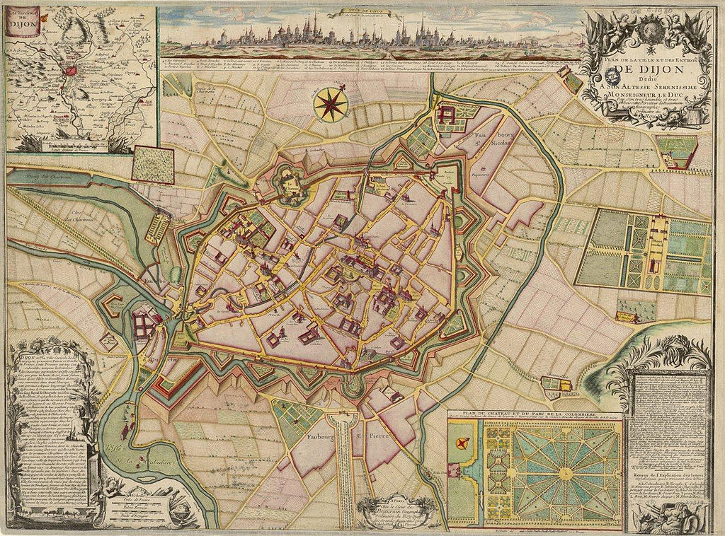
Français : Plan de la Ville et des Environs de Dijon (1730) |
| Date | |
| Source | http://catalogue.bnf.fr/ark:/12148/cb40635367f |
| Author | Denoinville (architecte et ingénieur) Cartographe & Beaurain Jean Cartographe. Graveur & Gambu André (arpenteur) Cartographe & Inselin Charles Graveur |
Licensing
[edit]
| Previous public domain rationale, no longer applicable | ||
|---|---|---|
|
File history
Click on a date/time to view the file as it appeared at that time.
| Date/Time | Thumbnail | Dimensions | User | Comment | |
|---|---|---|---|---|---|
| current | 17:11, 19 June 2013 | | 1,347 × 997 (1.88 MB) | François de Dijon (talk | contribs) | User created page with UploadWizard |
You cannot overwrite this file.
File usage on Commons
There are no pages that use this file.
File usage on other wikis
The following other wikis use this file:
- Usage on zh.wikipedia.org