File:Plan de Pau et ses environs édité pour le Central Office.jpg
Original file (1,384 × 1,054 pixels, file size: 374 KB, MIME type: image/jpeg)
Captions
Captions
This file may not have the correct information on its copyright status.
Notify the uploader with:
Items tagged with this template are sorted into Category:Items with disputed copyright information.
|
Summary
[edit]
| Description |
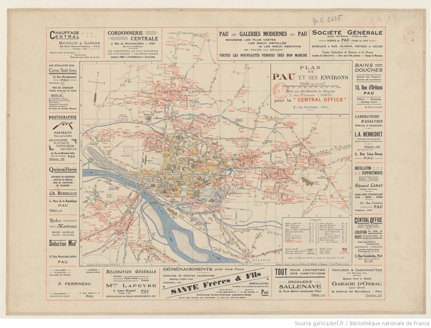
Français : Plan de Pau et ses environs en 1929
English: Map of Pau and surrounding areas in 1929 |
| Date | |
| Source | https://gallica.bnf.fr/ark:/12148/btv1b53066578h |
| Author | E. Blondel-la-Rougery |
Licensing
[edit]
- You are free:
- to share – to copy, distribute and transmit the work
- to remix – to adapt the work
- Under the following conditions:
- attribution – You must give appropriate credit, provide a link to the license, and indicate if changes were made. You may do so in any reasonable manner, but not in any way that suggests the licensor endorses you or your use.
- share alike – If you remix, transform, or build upon the material, you must distribute your contributions under the same or compatible license as the original.
File history
Click on a date/time to view the file as it appeared at that time.
| Date/Time | Thumbnail | Dimensions | User | Comment | |
|---|---|---|---|---|---|
| current | 16:28, 2 February 2021 | | 1,384 × 1,054 (374 KB) | Pofk (talk | contribs) | Uploaded a work by E. Blondel-la-Rougery from https://gallica.bnf.fr/ark:/12148/btv1b53066578h with UploadWizard |
You cannot overwrite this file.
File usage on Commons
There are no pages that use this file.
File usage on other wikis
The following other wikis use this file:
- Usage on fr.wikipedia.org