File:Plan and map of the fortress of Okopy.jpg
Jump to navigation
Jump to search

Size of this preview: 673 × 600 pixels. Other resolutions: 269 × 240 pixels | 539 × 480 pixels | 862 × 768 pixels | 1,149 × 1,024 pixels | 2,298 × 2,048 pixels | 6,482 × 5,777 pixels.
Original file (6,482 × 5,777 pixels, file size: 2.77 MB, MIME type: image/jpeg)
Captions
Captions
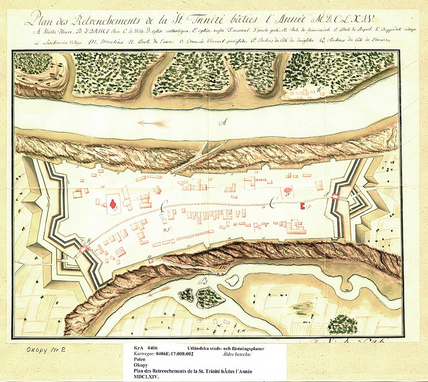
Plan and map of the fortress of Okopy
Summary
[edit]| Description |
English: Plan and map of the fortress of Okopy, now in Ukraine, then in the Polish-Lithuanian Commonwealth. |
||||||||||||||||||||||||||
| Date | |||||||||||||||||||||||||||
| Source |
|
||||||||||||||||||||||||||
| Creator |
|
||||||||||||||||||||||||||
| Permission (Reusing this file) |
|
||||||||||||||||||||||||||
| Georeferencing | If inappropriate please set warp_status = skip to hide. | ||||||||||||||||||||||||||
| Other versions | |||||||||||||||||||||||||||


.jpg)
Licensing
[edit]
|
This work is in the public domain in its country of origin and other countries and areas where the copyright term is the author's life plus 70 years or fewer. | |
| This file has been identified as being free of known restrictions under copyright law, including all related and neighboring rights. | |
File history
Click on a date/time to view the file as it appeared at that time.
| Date/Time | Thumbnail | Dimensions | User | Comment | |
|---|---|---|---|---|---|
| current | 14:08, 20 March 2023 | | 6,482 × 5,777 (2.77 MB) | DivadH (talk | contribs) | Uploaded a work by Unknown from https://sok.riksarkivet.se/arkiv/ZfvjvAaAwasJqzhBZbEem6 with UploadWizard |
You cannot overwrite this file.
File usage on Commons
The following 2 pages use this file: