File:Plan Starego Miasta w Malborku.JPG
Jump to navigation
Jump to search
Size of this preview: 557 × 599 pixels. Other resolutions: 223 × 240 pixels | 446 × 480 pixels | 714 × 768 pixels | 952 × 1,024 pixels | 2,292 × 2,466 pixels.
Original file (2,292 × 2,466 pixels, file size: 1.38 MB, MIME type: image/jpeg)
Captions
Captions
Add a one-line explanation of what this file represents
Summary
[edit]
| Description |
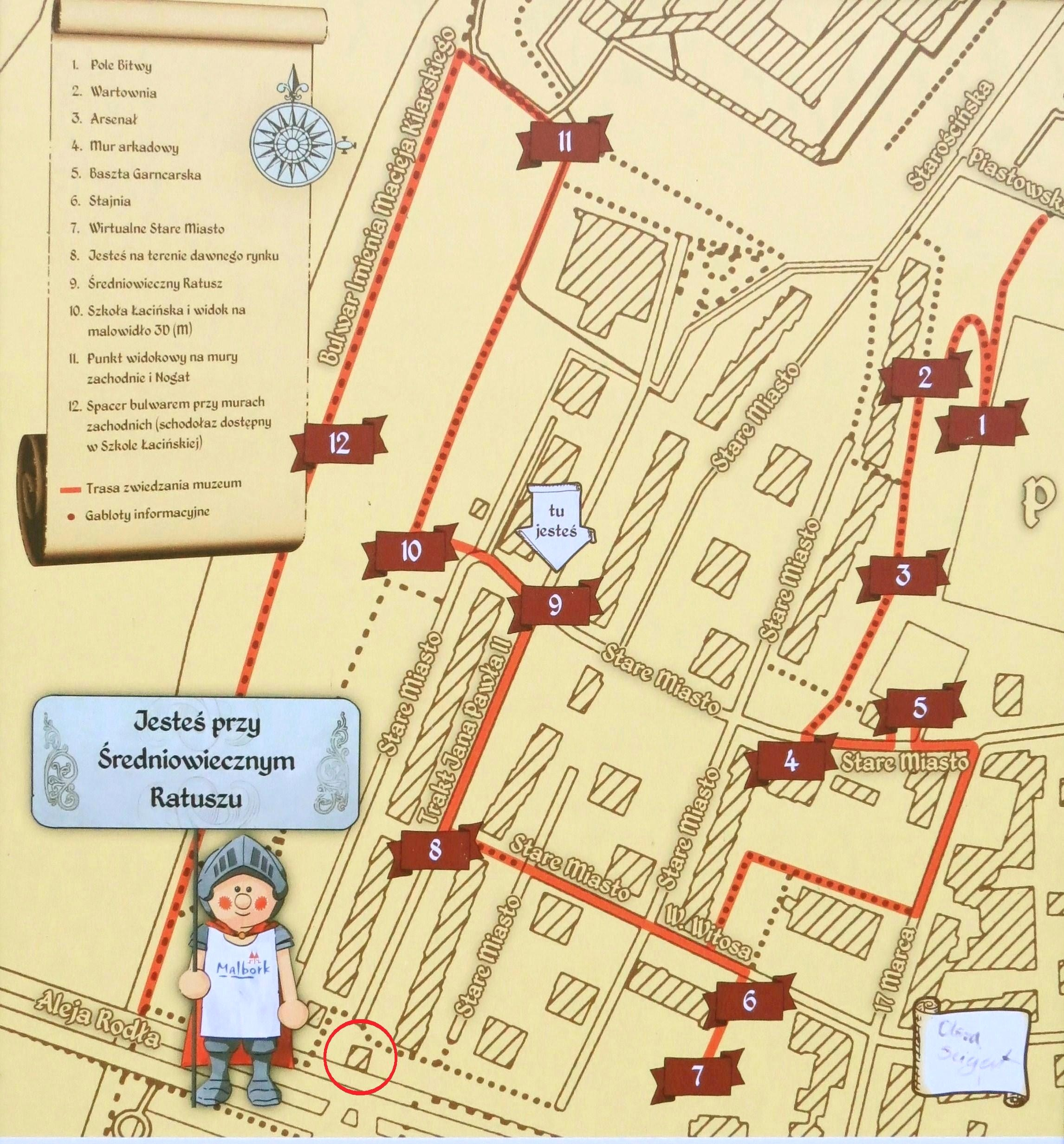
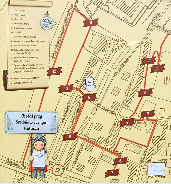
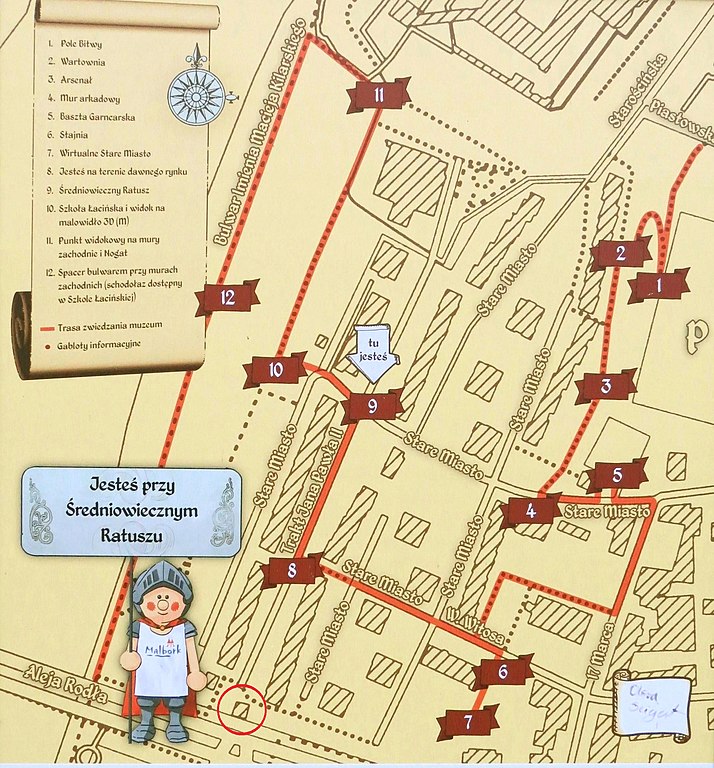
Polski: Współczesny plan Starego Miasta w Malborku. W czerwonym kółku Brama Mariacka, nr 5 - Baszta Garncarska, nr 9 - ratusz. |
| Date | |
| Source | a cropped version of the file:Malbork scheme.jpg |
| Author | Аимаина хикари |
| Camera location | | View this and other nearby images on: OpenStreetMap |
|---|
Licensing
[edit]
I, the copyright holder of this work, hereby publish it under the following license:
| This file is made available under the Creative Commons CC0 1.0 Universal Public Domain Dedication. | |
| The person who associated a work with this deed has dedicated the work to the public domain by waiving all of their rights to the work worldwide under copyright law, including all related and neighboring rights, to the extent allowed by law. You can copy, modify, distribute and perform the work, even for commercial purposes, all without asking permission.
|
|
The copyright act from February 4, 1994 in article 33 point 1 allows the propagation of works that are permanently exhibited on publicly accessible roads, streets, squares or gardens provided that the propagation is not for the same use. The name of the creator and source should be provided if it is possible by article 34. This use is royalty free, provided that it does not harm the legitimate interests of the creator by article 34.
See Copyright rights in Poland § Freedom of Panorama for more information.
|
File history
Click on a date/time to view the file as it appeared at that time.
| Date/Time | Thumbnail | Dimensions | User | Comment | |
|---|---|---|---|---|---|
| current | 19:29, 14 May 2020 | | 2,292 × 2,466 (1.38 MB) | Artur Andrzej (talk | contribs) | {{Information |description={{pl|1=Współczesny plan Starego Miasta w Malborku. W kółku Brama Mariacka.}} |date=2018-12-06 15:13 |source=a cropped version of the file:Malbork scheme.jpg |author=Аимаина хикари |permission= |other versions= }} {{Location|54.037181|19.026278}} =={{int:license-header}}== {{self|cc-zero}} {{Template:FoP-Poland}} Category:Old Town Hall of Malbork Category:Mariacka Gate in Malbork Category:Maps of Malbork |
You cannot overwrite this file.
File usage on Commons
There are no pages that use this file.