File:Plan SPb 1828.jpg
Jump to navigation
Jump to search
No higher resolution available.
Plan_SPb_1828.jpg (562 × 400 pixels, file size: 44 KB, MIME type: image/jpeg)
Captions
Captions
Add a one-line explanation of what this file represents
Summary
[edit]
| Description |
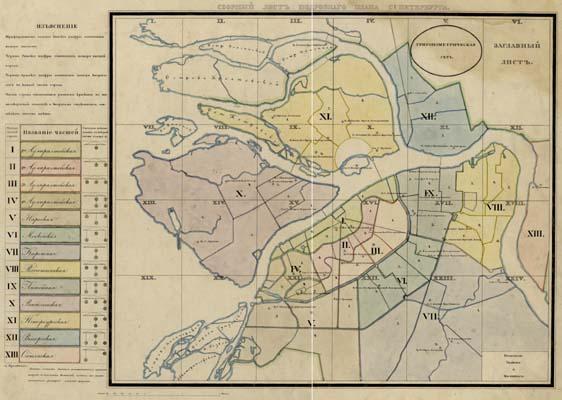
Русский: Карта Санкт-Петербурга. Подробный план столичного города Ст. Петербурга. 1828
English: Map of Saint Petersburg (Russia)
Français : Carte de Saint-Pétersbourg.
Español: Mapa de San Petersburgo.
Deutsch: Karte der Sankt Petersburg. |
| Date | |
| Source | http://www.nlr.ru/fonds/maps/spb.htm |
| Author | Шуберт Федор Федорович. |
Licensing
[edit]
|
This work is in the public domain in its country of origin and other countries and areas where the copyright term is the author's life plus 70 years or fewer. | |
| This file has been identified as being free of known restrictions under copyright law, including all related and neighboring rights. | |
File history
Click on a date/time to view the file as it appeared at that time.
| Date/Time | Thumbnail | Dimensions | User | Comment | |
|---|---|---|---|---|---|
| current | 12:01, 10 June 2010 | | 562 × 400 (44 KB) | Peterburg23 (talk | contribs) | крупнее масштаб |
| 11:59, 10 June 2010 |  | 564 × 400 (51 KB) | Peterburg23 (talk | contribs) | {{Information |Description= {{Ru|Карта Санкт-Петербурга. Подробный план столичного города Ст. Петербурга. 1828}} {{En|Map of [[:en:Saint Petersburg|Saint Pe |
You cannot overwrite this file.
File usage on Commons
There are no pages that use this file.
File usage on other wikis
The following other wikis use this file:
- Usage on ru.wikipedia.org