File:Plan Caudan Lanester 1758 2.jpg
Jump to navigation
Jump to search
Size of this preview: 800 × 540 pixels. Other resolutions: 320 × 216 pixels | 640 × 432 pixels | 1,024 × 691 pixels | 1,321 × 892 pixels.
Original file (1,321 × 892 pixels, file size: 882 KB, MIME type: image/jpeg)
Captions
Captions
Add a one-line explanation of what this file represents
Summary
[edit]
| Description |
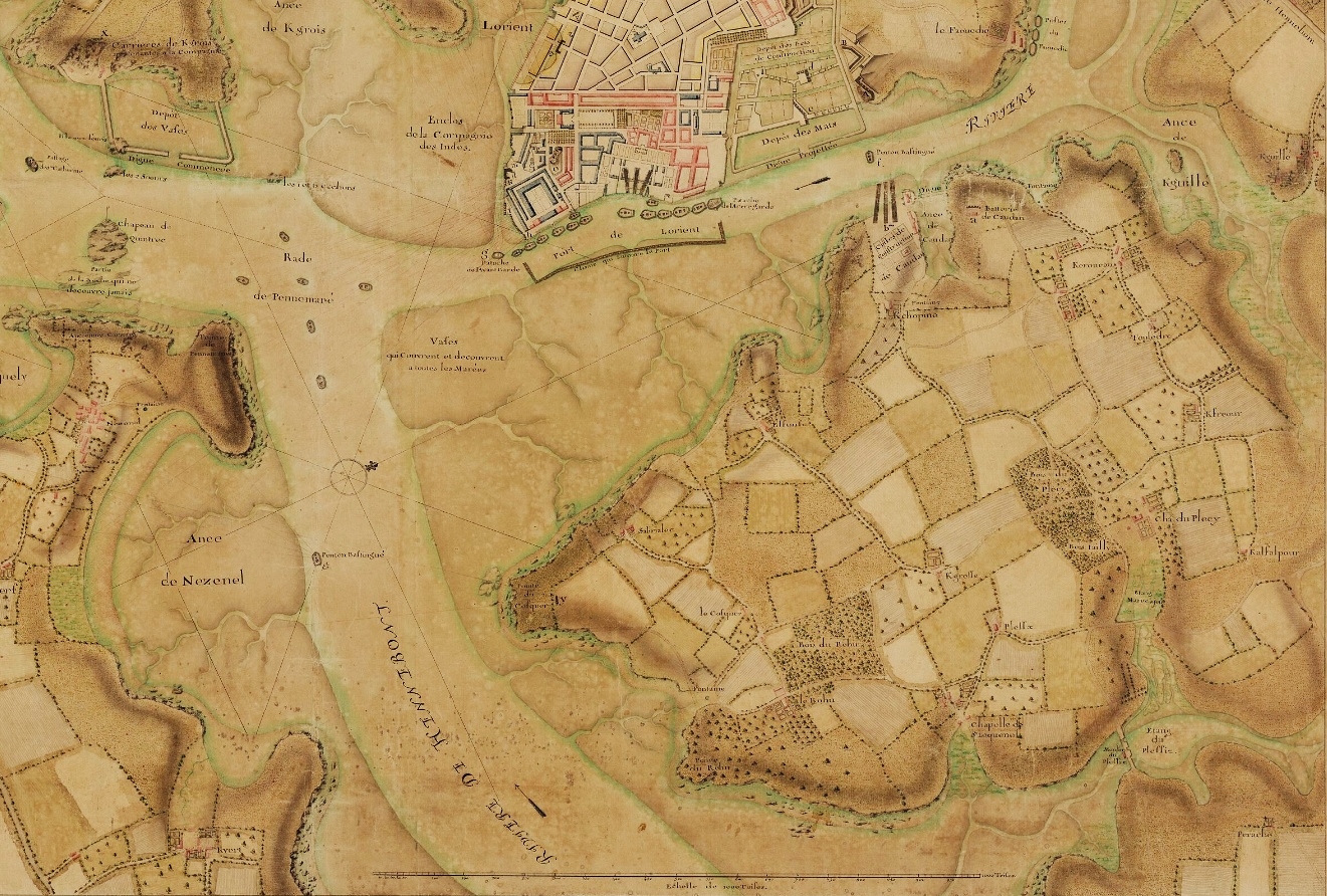
Français : Carte de la Pointe de Caudan (correspondant à une partie de l'actuelle commune de Lanester) et de ses environs datant de 1758. |
| Date | |
| Source | https://gallica.bnf.fr/ark:/12148/btv1b55010169w/f1.item.r=Lorient |
| Author | De Saint-Pierre |
Licensing
[edit]
|
This work is in the public domain in its country of origin and other countries and areas where the copyright term is the author's life plus 70 years or fewer. This work is in the public domain in the United States because it was published (or registered with the U.S. Copyright Office) before January 1, 1929. | |
| This file has been identified as being free of known restrictions under copyright law, including all related and neighboring rights. | |
File history
Click on a date/time to view the file as it appeared at that time.
| Date/Time | Thumbnail | Dimensions | User | Comment | |
|---|---|---|---|---|---|
| current | 04:18, 29 June 2022 | | 1,321 × 892 (882 KB) | Moreau.henri (talk | contribs) | Uploaded a work by De Saint-Pierre from https://gallica.bnf.fr/ark:/12148/btv1b55010169w/f1.item.r=Lorient with UploadWizard |
You cannot overwrite this file.
File usage on Commons
There are no pages that use this file.
File usage on other wikis
The following other wikis use this file:
- Usage on fr.wikipedia.org