File:Plan Brobargen.svg
Jump to navigation
Jump to search

Size of this PNG preview of this SVG file: 800 × 565 pixels. Other resolutions: 320 × 226 pixels | 640 × 452 pixels | 1,024 × 724 pixels | 1,280 × 905 pixels | 2,560 × 1,809 pixels | 1,200 × 848 pixels.
Original file (SVG file, nominally 1,200 × 848 pixels, file size: 26 KB)
Captions
Captions
Add a one-line explanation of what this file represents
| Description |
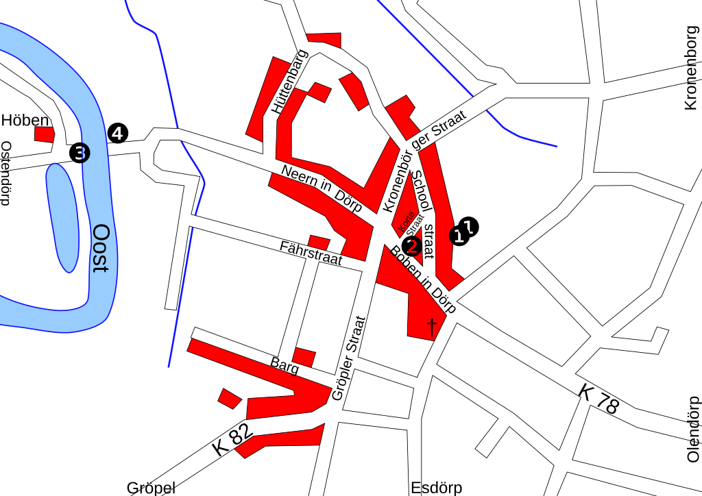
Plattdüütsch: Plaan vun’n Oort Brobargen in Neddersassen, Düütschland.
Deutsch: Übersichtsplan des Ortes Brobergen in Niedersachsen, Deutschland.
English: Map of the village Brobergen in Lower Saxony, Germany.
|
| Source | Own work |
| Author | Slomox |
| Permission (Reusing this file) |
This file is licensed under the Creative Commons Attribution-Share Alike 1.0 Generic license.
|
File history
Click on a date/time to view the file as it appeared at that time.
| Date/Time | Thumbnail | Dimensions | User | Comment | |
|---|---|---|---|---|---|
| current | 03:17, 29 April 2008 | | 1,200 × 848 (26 KB) | Slomox (talk | contribs) | {{Information |Description= {{nds|Plaan vun’n Oort Brobargen in Neddersassen, Düütschland. * ❶ wiest dat Dörpgemeenschopshuus oder Sport- un Kulturzentrum * ❷ wiest de Freewillige Füerwehr * ❸ wiest de Fähr över de Oost |
You cannot overwrite this file.
File usage on Commons
There are no pages that use this file.
File usage on other wikis
The following other wikis use this file:
- Usage on nds.wikipedia.org