File:Place Viger original floor plan.png
Jump to navigation
Jump to search
Size of this preview: 800 × 392 pixels. Other resolutions: 320 × 157 pixels | 640 × 314 pixels | 1,536 × 753 pixels.
Original file (1,536 × 753 pixels, file size: 195 KB, MIME type: image/png)
Captions
Captions
Add a one-line explanation of what this file represents
Summary
[edit]
| Description |
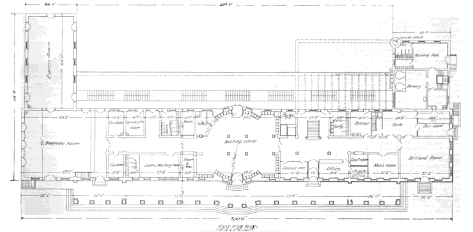
English: Original floor plan, Canadian Pacific Station, later "Place Viger", 700 rue Saint Antoine Est, Montreal, Quebec, Canada. It was originally designed as a combination hotel-railway station. |
| Date | |
| Source | "Railway Age and Northwestern Railroader", Volume 21, Number 24, June 13, 1896, page 311. |
| Author | Architect: Bruce Price |
| Object location | | View this and other nearby images on: OpenStreetMap |
|---|
Licensing
[edit]
This work is in the public domain in the United States because it was published (or registered with the U.S. Copyright Office) before January 1, 1929.
Public domain works must be out of copyright in both the United States and in the source country of the work in order to be hosted on the Commons. If the work is not a U.S. work, the file must have an additional copyright tag indicating the copyright status in the source country.
Note: This tag should not be used for sound recordings. |
File history
Click on a date/time to view the file as it appeared at that time.
| Date/Time | Thumbnail | Dimensions | User | Comment | |
|---|---|---|---|---|---|
| current | 02:37, 24 April 2022 | | 1,536 × 753 (195 KB) | Canadian2006 (talk | contribs) | Uploaded a work by Architect: Bruce Price from "Railway Age and Northwestern Railroader", Volume 21, Number 24, June 13, 1896, page 311. with UploadWizard |
You cannot overwrite this file.
File usage on Commons
There are no pages that use this file.