File:Pipe Springs National Monument, Arizona (15).jpg

Original file (2,816 × 2,112 pixels, file size: 3.59 MB, MIME type: image/jpeg)
Captions
Captions
Summary
[edit].jpg&action=edit§ion=1)
| Description |
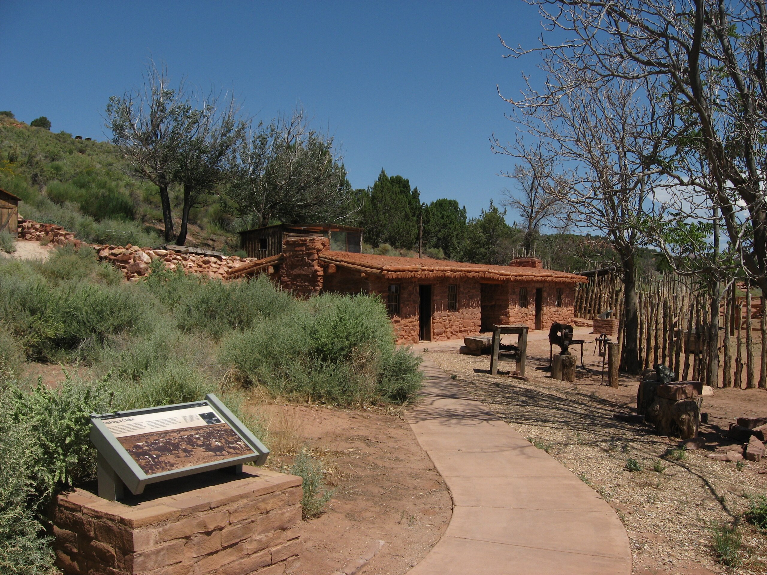
Pipe Spring National Monument is located in the U.S. state of Arizona, and is rich with American Indian, early explorer, and Mormon pioneer history. The National Monument was listed on the National Register of Historic Places on October 15, 1966, and the boundaries of the Pipe Spring National Monument Historic District (a portion of the monument) were expanded in October 2000. The water of Pipe Spring has made it possible for plants, animals, and people to live in this dry desert region. Ancestral Puebloans and Kaibab Paiute Indians gathered grass seeds, hunted animals, and raised crops near the springs for at least 1,000 years. Pipe Springs was discovered and named by the 1858 Latter-day Saint missionary expedition to the Hopi mesas led by Jacob Hamblin. In the 1860s Mormon pioneers from St. George, Utah, led by James M. Whitmore brought cattle to the area and a large cattle ranching operation was established. In 1866, conflict with the native peoples of the area, Navajo and Paiute, flashed into violence, and by 1872 a protective fort was built over the main spring. The following year the fort and ranch was purchased by Brigham Young for the The Church of Jesus Christ of Latter-day Saints. The LDS Bishop of near-by Grafton, Utah, Anson Perry Winsor, was hired to operate the ranch and maintain the fort, soon called Winsor Castle. This isolated outpost served as a way station for people traveling across the Arizona Strip, that part of Arizona separated from the rest of the state by the Grand Canyon. It also served as a refuge for polygamist wives during the 1880s and 1890s. The LDS church lost ownership of the property through penalties involved in the federal Edmunds-Tucker Act of 1887. Although their way of life was greatly impacted by Mormon settlement, the Paiute Indians continued to live in the area and by 1907 the Kaibab Paiute Indian Reservation was established, surrounding the privately owned Pipe Spring ranch. In 1923 the Pipe Spring ranch was purchased and set aside as a national monument, a memorial of western pioneer life.. Today the Pipe Spring National Monument - Kaibab Band of Paiute Indians Visitor Center and Museum explains the human history of the area over time. Daily tours of Winsor Castle, summer "living history" demonstrations, an orchard and garden, and a half-mile trail offer a glimpse of American Indian and pioneer life in the Old West. The Paiute tribe runs a small adjoining campground. en.wikipedia.org/wiki/Pipe_Spring_National_Monument |
| Date | |
| Source |
Pipe Springs National Monument, Arizona (15)
|
| Author | Ken Lund from Las Vegas, Nevada, USA |
| Camera location | | View this and other nearby images on: OpenStreetMap |
|---|
.jpg¶ms=036.861943_N_-112.739027_E_globe:Earth_type:camera_source:Flickr_&language=en)
Licensing
[edit].jpg&action=edit§ion=2)
- You are free:
- to share – to copy, distribute and transmit the work
- to remix – to adapt the work
- Under the following conditions:
- attribution – You must give appropriate credit, provide a link to the license, and indicate if changes were made. You may do so in any reasonable manner, but not in any way that suggests the licensor endorses you or your use.
- share alike – If you remix, transform, or build upon the material, you must distribute your contributions under the same or compatible license as the original.
| This image, originally posted to Flickr, was reviewed on December 29, 2011 by the administrator or reviewer File Upload Bot (Magnus Manske), who confirmed that it was available on Flickr under the stated license on that date. |
File history
Click on a date/time to view the file as it appeared at that time.
| Date/Time | Thumbnail | Dimensions | User | Comment | |
|---|---|---|---|---|---|
| current | 10:08, 29 December 2011 | | 2,816 × 2,112 (3.59 MB) | File Upload Bot (Magnus Manske) (talk | contribs) | {{Information |Description=Pipe Spring National Monument is located in the U.S. state of Arizona, and is rich with American Indian, early explorer, and Mormon pioneer history. The National Monument was listed on the National Register of Historic Places on |
You cannot overwrite this file.
File usage on Commons
The following 2 pages use this file:
_(3733760105).jpg&redirect=no)
File usage on other wikis
The following other wikis use this file:
- Usage on de.wikipedia.org
- Usage on de.wikivoyage.org
.jpg&oldid=763493910)