File:Piotrków Trybunalski location map.png
Jump to navigation
Jump to search
Size of this preview: 800 × 547 pixels. Other resolutions: 320 × 219 pixels | 640 × 438 pixels | 861 × 589 pixels.
Original file (861 × 589 pixels, file size: 296 KB, MIME type: image/png)
Captions
Captions
Add a one-line explanation of what this file represents
| Description |
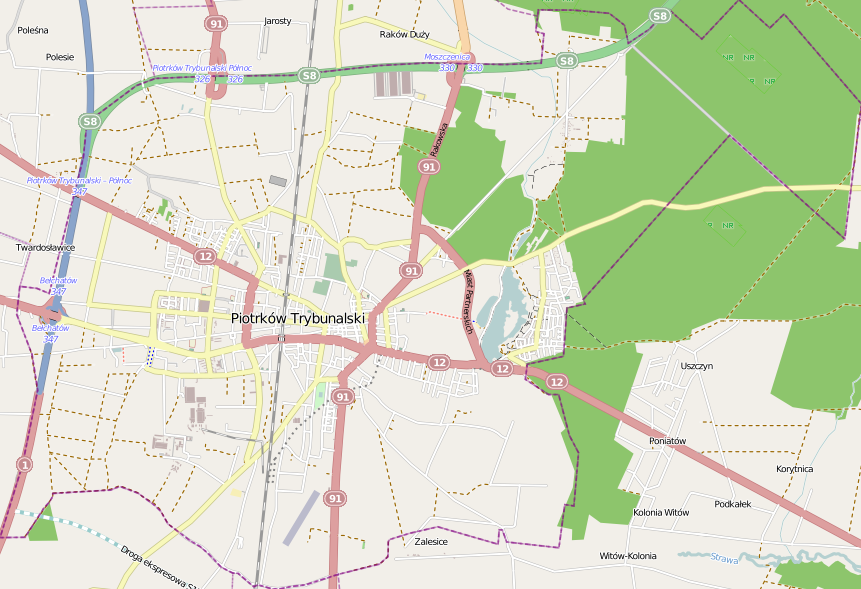
Location map of Piotrków Trybunalski, Poland This map of Piotrków Trybunalski was created from OpenStreetMap project data, collected by the community. This map may be incomplete, and may contain errors. Don't rely solely on it for navigation. |
|||||||||
| Date | ||||||||||
| Source | You may find a page on the OpenStreetMap wiki page for Piotrków Trybunalski | |||||||||
| Creator |
OpenStreetMap contributors OpenStreetMap contributors |
|||||||||
| Permission (Reusing this file) |
OpenStreetMap data is available under the Open Database License (details). Map tiles are licensed under the Creative Commons Attribution-ShareAlike 2.0 license (CC-BY-SA 2.0).
This file is licensed under the Creative Commons Attribution-Share Alike 2.0 Generic license.
|
|||||||||
| Geotemporal data | ||||||||||
| Bounding box |
|
|||||||||
| Georeferencing | If inappropriate please set warp_status = skip to hide. | |||||||||
File history
Click on a date/time to view the file as it appeared at that time.
| Date/Time | Thumbnail | Dimensions | User | Comment | |
|---|---|---|---|---|---|
| current | 14:48, 10 November 2013 | | 861 × 589 (296 KB) | Powerek38 (talk | contribs) | VicuñaUploader 1.18 |
You cannot overwrite this file.
File usage on Commons
There are no pages that use this file.
File usage on other wikis
The following other wikis use this file:
- Usage on pl.wikipedia.org
- Browar Piotrków
- Kleszcz
- Piotrków Trybunalski (stacja kolejowa)
- Wierzeje
- Osiedle Wysoka Łódzka (Piotrków Trybunalski)
- Kościół Podwyższenia Krzyża Świętego w Piotrkowie Trybunalskim
- Wielka Synagoga w Piotrkowie Trybunalskim
- Osiedle 35-lecia (Piotrków Trybunalski)
- Wieża ciśnień w Piotrkowie Trybunalskim
- Miejska Biblioteka Publiczna im. Adama Próchnika w Piotrkowie Trybunalskim
- Lotnisko Piotrków Trybunalski
- I Liceum Ogólnokształcące im. Bolesława Chrobrego w Piotrkowie Trybunalskim
- Osiedle Wyzwolenia (Piotrków Trybunalski)
- Centrum (Piotrków Trybunalski)
- Jeziorna (Piotrków Trybunalski)
- Rondo Sulejowskie w Piotrkowie Trybunalskim
- Piotrkowska Manufaktura
- Zamek Królewski w Piotrkowie Trybunalskim
- Synagoga chasydów z Mszczonowa w Piotrkowie Trybunalskim
- Parafia Miłosierdzia Bożego w Piotrkowie Trybunalskim
- Bugaj (jezioro)
- Byki (Piotrków Trybunalski)
- Bugaj (Piotrków Trybunalski)
- Osiedle Piastowskie (Piotrków Trybunalski)
- Cerkiew Wszystkich Świętych w Piotrkowie Trybunalskim
- Cmentarz Żołnierzy Radzieckich w Piotrkowie Trybunalskim
- Meszcze
- Osiedle Mickiewicza (Piotrków Trybunalski)
- Osiedle Wronia
- Nowy cmentarz żydowski w Piotrkowie Trybunalskim
- Stary cmentarz żydowski w Piotrkowie Trybunalskim
- Osiedle Słowackiego Północ (Piotrków Trybunalski)
- Parafia Wszystkich Świętych w Piotrkowie Trybunalskim
- Ulica Juliusza Słowackiego w Piotrkowie Trybunalskim
- Osiedle Żwirki (Piotrków Trybunalski)
- Rezerwat przyrody Meszcze
- Piotrków Trybunalski Wąskotorowy
- Parafia Najświętszego Serca Jezusowego w Piotrkowie Trybunalskim
- Parafia Nawiedzenia Najświętszej Maryi Panny w Piotrkowie Trybunalskim
- Parafia św. Alberta Chmielowskiego w Piotrkowie Trybunalskim
- Parafia św. Jakuba Apostoła w Piotrkowie Trybunalskim
- Parafia św. Jacka i św. Doroty w Piotrkowie Trybunalskim
- Parafia Najświętszej Maryi Panny Królowej Pokoju w Piotrkowie Trybunalskim
- Milejówka
- Starostwo (przystanek kolejowy)
- Bugaj Piotrkowski
- Piotrków Trybunalski Towarowy
- Stary Cmentarz Rzymskokatolicki w Piotrkowie Trybunalskim
- Zespół klasztorny dominikanek w Piotrkowie Trybunalskim
- Huta Szkła Gospodarczego „Hortensja”
View more global usage of this file.