File:Pillow Lava at Wadi Jizzi in Oman.jpg
Jump to navigation
Jump to search

Size of this preview: 800 × 533 pixels. Other resolutions: 320 × 213 pixels | 640 × 427 pixels | 1,024 × 683 pixels | 1,280 × 853 pixels | 2,560 × 1,707 pixels | 5,472 × 3,648 pixels.
Original file (5,472 × 3,648 pixels, file size: 10.42 MB, MIME type: image/jpeg)
Captions
Captions
Add a one-line explanation of what this file represents
Summary
[edit]
| Description |
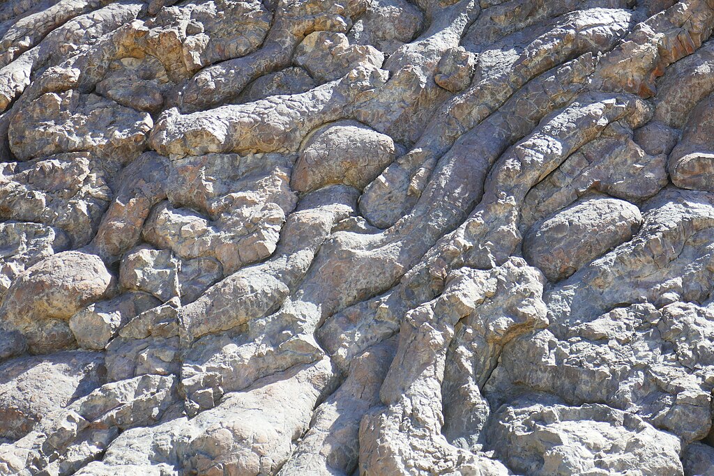
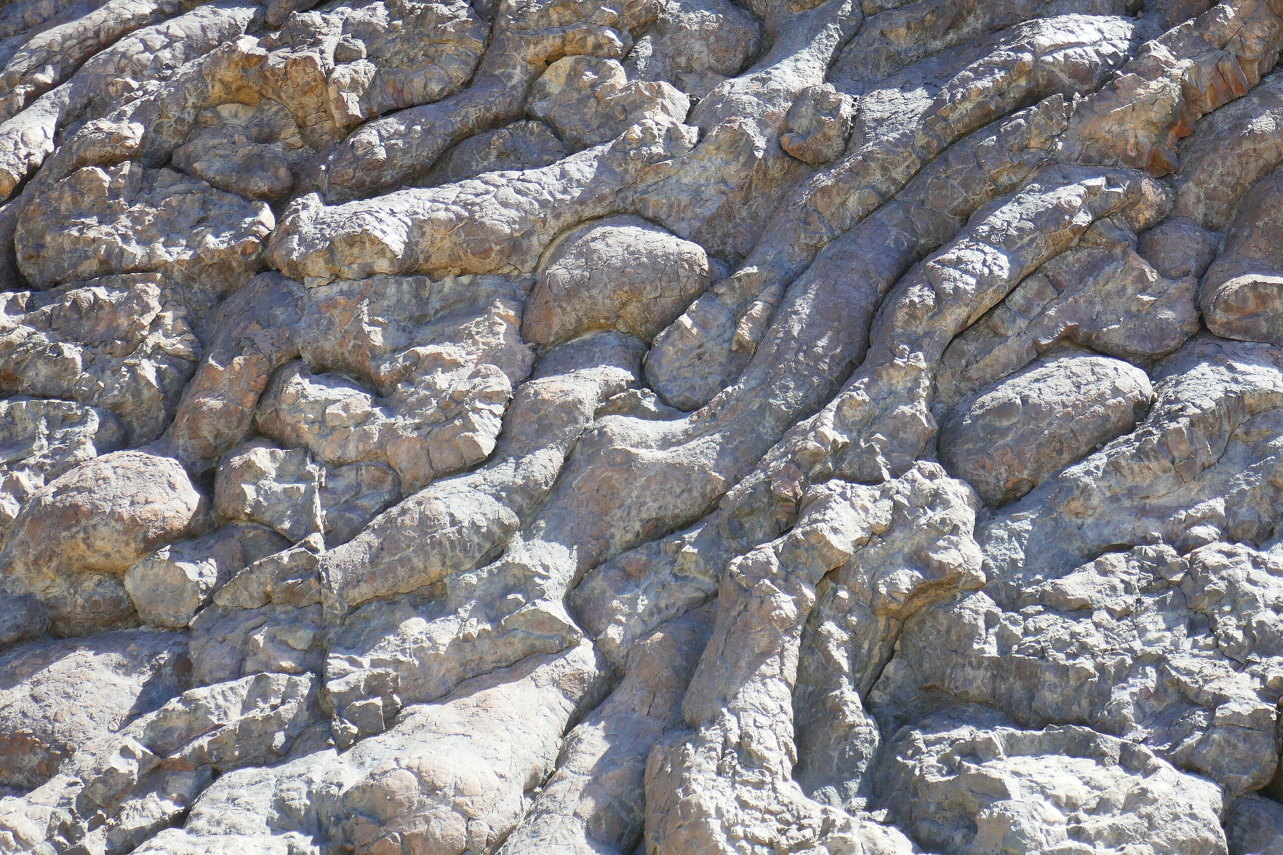
English: Pillow lava at Wadi Jizzi in Oman. The lava is part of the Semail ophiolite. This location is sometimes described informally by geologists as the Geotimes outcrop because the rocks at this location were featured in an issue of that geological magazine. Français : Un affleurement spectaculaire de pillows lavas océaniques qui appartenaient à la lithosphère téthysienne (mise en place jusqu’à environ -100Ma) avant leur charriage sur la plaque arabique par obduction, obduction qui s’est amorcée vers -95Ma. Ils appartiennent à l’ophiolithe d’Oman (dite aussi nappe de Semail) qui a commencé à être charriée sur le continent arabe il y a 85Ma après une dizaine de millions d’année de charriage océanique. Les pillows lavas présentés ici constituent le sommet de la partie crustale de la lithosphère et sont issus de l’éruption de laves basaltiques (MORB) à grande profondeur (environ 3000m) et qui ont subis une trempe à cause de l’eau froide (0°à 1°) présente. |
| Date | |
| Source | https://www.geodiversite.net/media1782 |
| Author | Lionel Duchoiselle (https://www.geodiversite.net/auteur386) |
| Camera location | | View this and other nearby images on: OpenStreetMap |
|---|
Licensing
[edit]
This file is licensed under the Creative Commons Attribution-Share Alike 3.0 Unported license.
- You are free:
- to share – to copy, distribute and transmit the work
- to remix – to adapt the work
- Under the following conditions:
- attribution – You must give appropriate credit, provide a link to the license, and indicate if changes were made. You may do so in any reasonable manner, but not in any way that suggests the licensor endorses you or your use.
- share alike – If you remix, transform, or build upon the material, you must distribute your contributions under the same or compatible license as the original.

|
This file, which was originally posted to an external website, has not yet been reviewed by an administrator or reviewer to confirm that the above license is valid. See Category:License review needed for further instructions.
|
File history
Click on a date/time to view the file as it appeared at that time.
| Date/Time | Thumbnail | Dimensions | User | Comment | |
|---|---|---|---|---|---|
| current | 13:59, 28 August 2020 | | 5,472 × 3,648 (10.42 MB) | GeoWriter (talk | contribs) | Uploaded a work by Lionel Duchoiselle (https://www.geodiversite.net/auteur386) from https://www.geodiversite.net/media1782 with UploadWizard |
You cannot overwrite this file.
File usage on Commons
The following page uses this file:
File usage on other wikis
The following other wikis use this file:
- Usage on en.wikipedia.org
- Usage on pt.wikipedia.org