File:Physical map of the Philippines.png
Jump to navigation
Jump to search

Size of this preview: 527 × 599 pixels. Other resolutions: 211 × 240 pixels | 422 × 480 pixels | 676 × 768 pixels | 901 × 1,024 pixels | 1,802 × 2,048 pixels | 3,131 × 3,559 pixels.
Original file (3,131 × 3,559 pixels, file size: 10.8 MB, MIME type: image/png)
Captions
Captions
Add a one-line explanation of what this file represents
Summary
[edit]
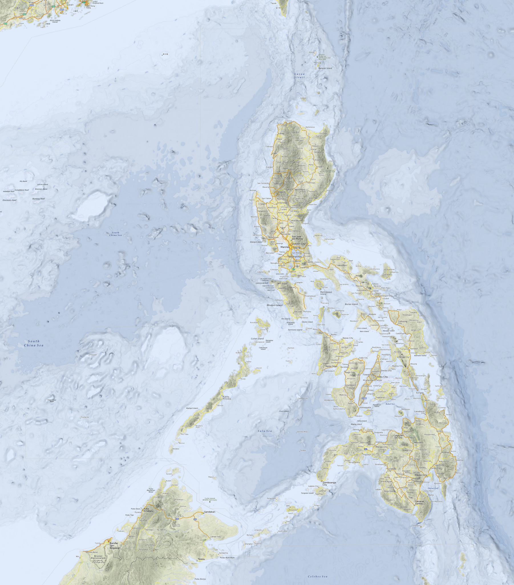
| Description |
Deutsch: Physische Karte der Philippinen
English: Physical map of the Philippines |
|||
| Date | see file history | |||
| Source | Own work, using a map rendered by OpenMapSurfer which uses OpenStreetMap | |||
| Author | Maximilian Dörrbecker (Chumwa) | |||
| Permission (Reusing this file) |
This file is licensed under the Creative Commons Attribution-Share Alike 2.0 Generic license.
Sie dürfen das Bild zu den folgenden Bedingungen nutzen:
|
File history
Click on a date/time to view the file as it appeared at that time.
| Date/Time | Thumbnail | Dimensions | User | Comment | |
|---|---|---|---|---|---|
| current | 22:53, 5 November 2013 | | 3,131 × 3,559 (10.8 MB) | Chumwa (talk | contribs) | == {{int:filedesc}} == {{Information |Description = {{de|1=Physische Karte der Philippinen}} {{en|1=Physical map of the Philippines}} |Source={{own}}, using a map rendered by [http://www.openmapsurfer.uni-hd.de/ OpenMapSurfer] which uses [[OpenStree... |
You cannot overwrite this file.
File usage on Commons
The following page uses this file:
File usage on other wikis
The following other wikis use this file:
- Usage on de.wikipedia.org
- Usage on uk.wikipedia.org