File:Physical Political World Map.jpg

Original file (6,480 × 3,888 pixels, file size: 5.69 MB, MIME type: image/jpeg)
Captions
Captions
| Description |
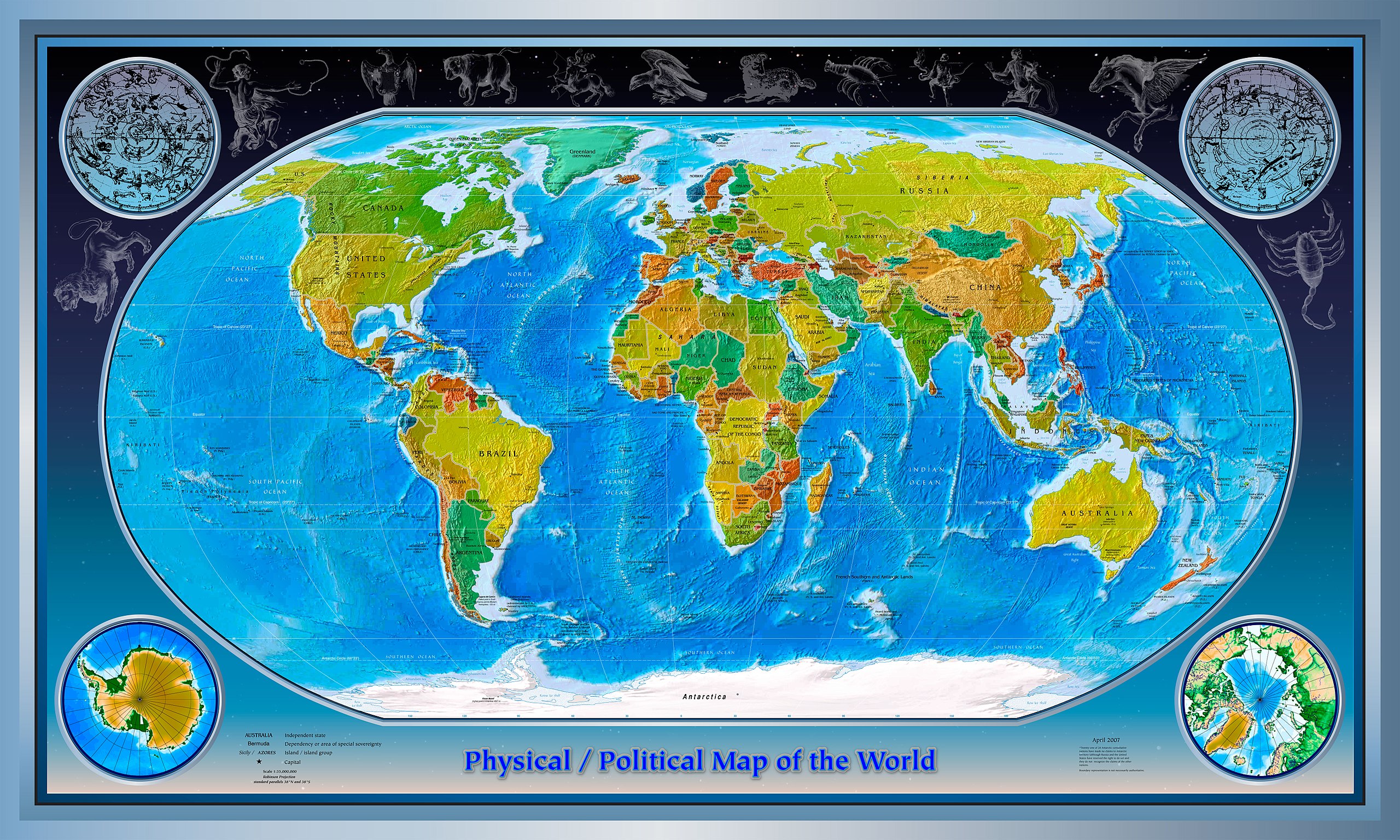
English: This is a composite of several images collected from the websites of the CIA and NASA.
Physical World Map 2007-04-01 CIA World Factbook; Robinson Projection; standard parallels 38°N and 38°S Subject: Physical map of the World, April, 2007 Projection: Robinson projection, Standard parallels, 38°N, 38°S Source: CIA World Factbook found at: https://www.cia.gov/library/publications/the-world-factbook/reference_maps/pdf/physical_world.pdf Political World Map 2007-04-01 CIA World Factbook; Robinson Projection; standard parallels 38°N and 38°S Subject: Political map of the World, April, 2007 Projection: Robinson projection, Standard parallels, 38°N, 38°S Source: CIA World Factbook found at: https://www.cia.gov/library/publications/the-world-factbook/reference_maps/pdf/political_world.pdf This image is in the public domain because it contains materials that originally came from the United States Central Intelligence Agency's World Factbook. Constellations (Hubblesource.stsci.edu) and Stary Field Background (Hubblesite.org) are public domain images from NASA.org http://hubblesource.stsci.edu/sources/illustrations/constellations/ http://hubblesite.org/gallery/album/ External links |
| Source | |
| Author |
Licensing
[edit]
This image is in the public domain because it contains materials that originally came from the United States Central Intelligence Agency's World Factbook.
|
 |
Original upload log
[edit]
- 2007-10-22 02:51 IMtheEyeInTheSky 6480×3888×??? (5961164 bytes) This is a composite of several images collected from the websites of the CIA and NASA. Physical World Map 2007-04-01 CIA World Factbook; Robinson Projection; standard parallels 38°N and 38°S Subject: Physical map of the World, April, 2007 Projection: R
File history
Click on a date/time to view the file as it appeared at that time.
| Date/Time | Thumbnail | Dimensions | User | Comment | |
|---|---|---|---|---|---|
| current | 12:31, 19 September 2008 | | 6,480 × 3,888 (5.69 MB) | Nk (talk | contribs) | {{Information |Description={{en|This is a composite of several images collected from the websites of the CIA and NASA. Physical World Map 2007-04-01 CIA World Factbook; Robinson Projection; standard parallels 38°N and 38°S Subject: Physical map of the |
You cannot overwrite this file.
File usage on Commons
There are no pages that use this file.
File usage on other wikis
The following other wikis use this file:
- Usage on bg.wikipedia.org
- Usage on en.wikipedia.org
- Usage on gl.wikipedia.org