File:Photo - Kassel Hafenbrücke - Hochwasser 1909.jpg

Original file (1,600 × 1,065 pixels, file size: 350 KB, MIME type: image/jpeg)
Captions
Captions
Summary
[edit]
| Description |
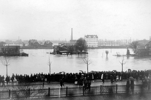
Deutsch: Hochwasser der Fulda in Kassel an der Hafenbrücke Februar 1909 |
| Date | |
| Source | https://mapio.net/place/21082869/ |
| Author | Unknown author |
| Camera location | | View this and other nearby images on: OpenStreetMap |
|---|
Licensing
[edit]
|
This work is in the public domain in its country of origin and other countries and areas where the copyright term is the author's life plus 70 years or fewer.
| |
| This file has been identified as being free of known restrictions under copyright law, including all related and neighboring rights. | |
File history
Click on a date/time to view the file as it appeared at that time.
| Date/Time | Thumbnail | Dimensions | User | Comment | |
|---|---|---|---|---|---|
| current | 19:58, 1 August 2018 | | 1,600 × 1,065 (350 KB) | DALIBRI (talk | contribs) | {{Information |description ={{de|1=Hochwasser der Fulda in Kassel an der Hafenbrücke Februar 1909}} |date =1909-02 |source =https://mapio.net/place/21082869/ |author ={{unknown|author}} }} Category:1909 floods Category:History of Kassel Category:Fulda (river) |
You cannot overwrite this file.
File usage on Commons
There are no pages that use this file.