File:Phoenix Center and Ottawa Towers, Pontiac, Michigan - 20201213.jpg
Jump to navigation
Jump to search
Size of this preview: 800 × 450 pixels. Other resolutions: 320 × 180 pixels | 640 × 360 pixels | 1,024 × 576 pixels | 1,280 × 720 pixels | 3,602 × 2,026 pixels.
Original file (3,602 × 2,026 pixels, file size: 1.85 MB, MIME type: image/jpeg)
Captions
Captions
Add a one-line explanation of what this file represents
Summary
[edit]
| Description |
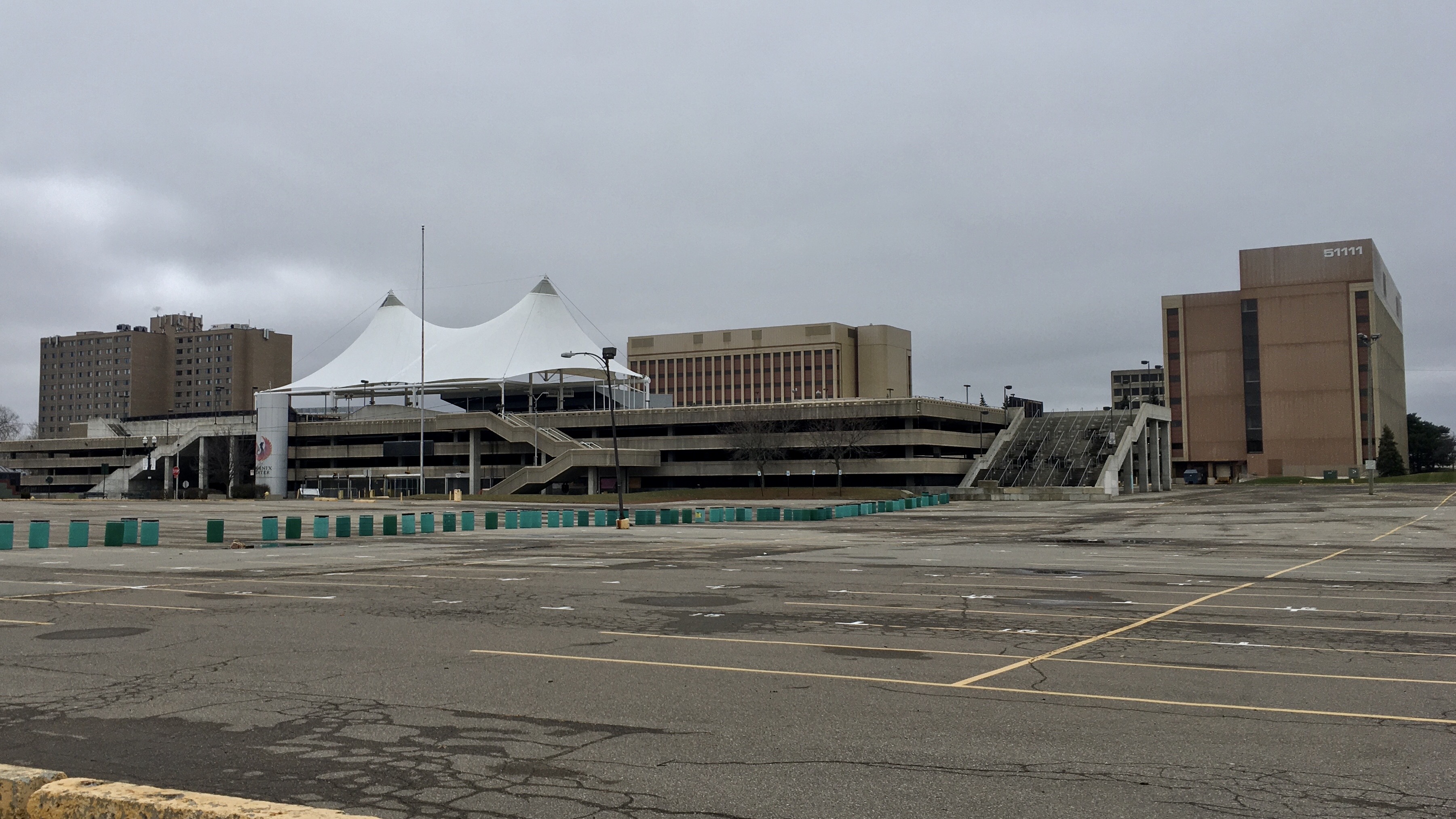
English: As seen in December 2020: the Phoenix Center, the centerpiece of Pontiac, Michigan's downtown district, a monument to the city's urban renewal era, and - in the words of the Oakland Press - "a massive concrete metaphor for what the city has experienced since the 2008 recession - losing nearly everything, hanging on to what it can and finding hope in revitalization". A spacious amphitheater-style concert and event venue built above a large parking ramp with a pair of iconic white canopies crowning it, this stark Brutalist structure was built in phases beginning in 1973 and continuing through the early '80s and was envisioned as merely the first step in a complete reimagination of downtown Pontiac, in which high-rise office and apartment buildings, hotels, retail developments, an art museum, and an 8,000-seat sporting arena would reinvigorate the streets in an environment of strict segregation between pedestrians and automobiles. Other than the Phoenix Center itself, the only components of that plan that were ever realized were the Ottawa Towers, a pair of office buildings seen in the background at center and right, and the Phoenix Place senior apartment building (left), built in 1982 and 1984 respectively. The entire complex was orgered demolished by the municipal government in 2012, citing necessary structural repairs that the city couldn't afford, but a legal challenge from the owners of the Ottawa Towers has dragged through the courts for years and prevented the demolition from moving forward, all as redevelopment proposals come and go. |
| Date | |
| Source | Own work |
| Author | Andre Carrotflower |
| Camera location | | View this and other nearby images on: OpenStreetMap |
|---|
Licensing
[edit]
I, the copyright holder of this work, hereby publish it under the following license:
This file is licensed under the Creative Commons Attribution-Share Alike 4.0 International license.
- You are free:
- to share – to copy, distribute and transmit the work
- to remix – to adapt the work
- Under the following conditions:
- attribution – You must give appropriate credit, provide a link to the license, and indicate if changes were made. You may do so in any reasonable manner, but not in any way that suggests the licensor endorses you or your use.
- share alike – If you remix, transform, or build upon the material, you must distribute your contributions under the same or compatible license as the original.
File history
Click on a date/time to view the file as it appeared at that time.
| Date/Time | Thumbnail | Dimensions | User | Comment | |
|---|---|---|---|---|---|
| current | 16:32, 20 January 2021 | | 3,602 × 2,026 (1.85 MB) | Andre Carrotflower (talk | contribs) | Uploaded own work with UploadWizard |
You cannot overwrite this file.
File usage on Commons
There are no pages that use this file.