File:Philippine Navy MPAC Mk2 Panguan.jpg

Original file (4,032 × 3,024 pixels, file size: 1.62 MB, MIME type: image/jpeg)
Captions
Captions
Summary
[edit]| Description |
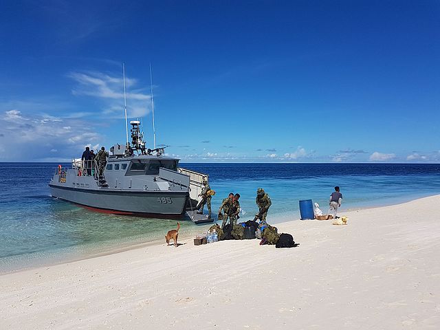
English: Philippine Navy's Multi-Purpose Attack Craft Mk2 BA-485 docked at Panguan Island of Tawi-Tawi province for a mapping, reconnaissance and deployment mission of the 10th Marine Battalion Landing Team of the Philippine Marine Corps and Schadow1 Expeditions |
||
| Date | |||
| Source | Own work | ||
| Author | Ervin Malicdem | ||
| Permission (Reusing this file) |
This file is licensed under the Creative Commons Attribution-Share Alike 4.0 International license.
|

| Camera location | | View this and other nearby images on: OpenStreetMap |
|---|
Initially published at Schadow1 Expeditions article available at http://www.s1expeditions.com/2017/06/215-panguan-island-tawitawi.html
Licensing
[edit]
- You are free:
- to share – to copy, distribute and transmit the work
- to remix – to adapt the work
- Under the following conditions:
- attribution – You must give appropriate credit, provide a link to the license, and indicate if changes were made. You may do so in any reasonable manner, but not in any way that suggests the licensor endorses you or your use.
- share alike – If you remix, transform, or build upon the material, you must distribute your contributions under the same or compatible license as the original.
File history
Click on a date/time to view the file as it appeared at that time.
| Date/Time | Thumbnail | Dimensions | User | Comment | |
|---|---|---|---|---|---|
| current | 05:18, 22 June 2017 | | 4,032 × 3,024 (1.62 MB) | Schadow1 (talk | contribs) | User created page with UploadWizard |
You cannot overwrite this file.
File usage on Commons
The following 4 pages use this file:
File usage on other wikis
The following other wikis use this file:
- Usage on en.wikipedia.org
- Usage on fr.wikipedia.org
- Usage on hi.wikipedia.org
- Usage on id.wikipedia.org
- Usage on ru.wikipedia.org
- Usage on www.wikidata.org
- Usage on zh.wikipedia.org