File:Phewa Lake In Pokhara (88736761).jpeg
Jump to navigation
Jump to search

Size of this preview: 800 × 533 pixels. Other resolutions: 320 × 213 pixels | 640 × 427 pixels | 1,024 × 683 pixels | 1,280 × 853 pixels | 2,048 × 1,365 pixels.
Original file (2,048 × 1,365 pixels, file size: 875 KB, MIME type: image/jpeg)
Captions
Captions
Add a one-line explanation of what this file represents
Summary
[edit].jpeg&action=edit§ion=1)
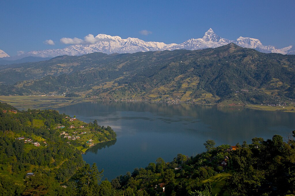
| Phewa Lake In Pokhara | |
|---|---|
| Photographer | |
| Title |
Phewa Lake In Pokhara |
| Description |
500px provided description: After a night in Kathmandu, our next stop towards Upper Mustang is Pokhara, just an half-hour flight from Katmandu with gorgeous views on the Himalayas all along (sit on the right of the aircraft). Pokhara is the second largest city of Nepal but, unlike the capital Kathmandu, it is quite loosely built up and still has much green space. The tourist district is along the north shore of Phewa lake. The Annapurna range on the north is only about 28 km away from the lake, and the lake is famous for the reflection of mount Machhapuchhre and other mountain peaks of the Annapurna and Dhaulagiri ranges on its surface. I still remember spending all the day there, back in the early eighties, just enjoying the fantastic view and feeling I was flying in the sky with the eagles after having picked the "magic mushroom omelet" on the breakfast menu Well this time has gone, but Pokhara is still one of the most enchanting place in the world and the new way to fly with the eagles is to have a tandem paraglider flight, a very popular activity these days. [#Nepal ,#Pokhara ,#Annapurna ,#Machhapuchchhre] |
| Date | 30 October 2014, 12:39:11 (UTC) |
| Source | Imported from 500px (archived version) by the Archive Team. (detail page) |
| Permission (Reusing this file) |
This file is licensed under the Creative Commons Attribution 3.0 Unported license.
|
| Camera location | | View this and other nearby images on: OpenStreetMap |
|---|
.jpeg¶ms=028.204061_N_0083.945103_E_globe:Earth_type:camera__&language=en)
File history
Click on a date/time to view the file as it appeared at that time.
| Date/Time | Thumbnail | Dimensions | User | Comment | |
|---|---|---|---|---|---|
| current | 19:39, 17 September 2018 | | 2,048 × 1,365 (875 KB) | Rodrigo.Argenton (talk | contribs) | Photo Phewa Lake In Pokhara imported from 500px with import-500px |
You cannot overwrite this file.
File usage on Commons
The following page uses this file:
.jpeg)
.jpeg&oldid=581683161)