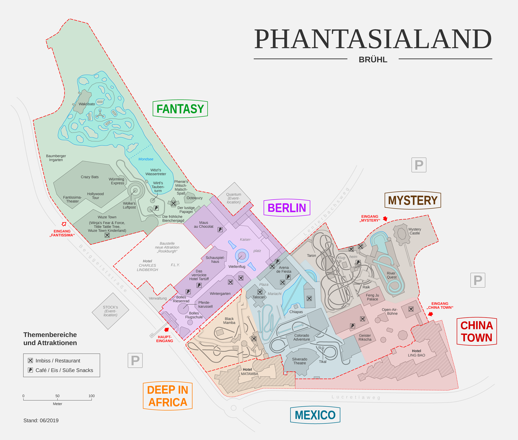
File:Phantasialand map DE.png
Jump to navigation
Jump to search
Size of this preview: 705 × 599 pixels. Other resolutions: 282 × 240 pixels | 565 × 480 pixels | 904 × 768 pixels | 1,205 × 1,024 pixels | 2,000 × 1,700 pixels.
Original file (2,000 × 1,700 pixels, file size: 763 KB, MIME type: image/png)
Captions
Captions
Add a one-line explanation of what this file represents
Summary
[edit]| Description | |||
| Date | |||
| Source | Own work | ||
| Author | Thoroe | ||
| Other versions |
|

| This work contains information from OpenStreetMap, which is made available under the Open Database License (ODbL).
The ODbL does not require any particular license for maps produced from ODbL data. Prior to 1 August 2020, map tiles produced by the OpenStreetMap Foundation were licensed under the CC-BY-SA-2.0 license. Maps produced by other people may be subject to other licences. |
Licensing
[edit]
This file is licensed under the Creative Commons Attribution-Share Alike 3.0 Unported license.
Attribution: Thomas Römer
- You are free:
- to share – to copy, distribute and transmit the work
- to remix – to adapt the work
- Under the following conditions:
- attribution – You must give appropriate credit, provide a link to the license, and indicate if changes were made. You may do so in any reasonable manner, but not in any way that suggests the licensor endorses you or your use.
- share alike – If you remix, transform, or build upon the material, you must distribute your contributions under the same or compatible license as the original.
File history
Click on a date/time to view the file as it appeared at that time.
| Date/Time | Thumbnail | Dimensions | User | Comment | |
|---|---|---|---|---|---|
| current | 11:51, 25 June 2019 | | 2,000 × 1,700 (763 KB) | Thoroe (talk | contribs) | Update Crazy Bats u.a. |
| 17:37, 3 April 2017 |  | 2,000 × 1,700 (777 KB) | Thoroe (talk | contribs) | Update | |
| 21:59, 14 October 2016 |  | 2,000 × 1,700 (771 KB) | Thoroe (talk | contribs) | {{Information |Description ={{en|1=Map of Phantasialand theme park, Brühl, Germany}} {{de|1=Karte des Freizeitparks Phantasialand, Brühl, Deutschland... |
You cannot overwrite this file.
File usage on Commons
There are no pages that use this file.
File usage on other wikis
The following other wikis use this file:
- Usage on de.wikipedia.org
- Usage on pl.wikipedia.org