File:Pfaelzerwaldkarte Pfaelzisch-Saarlaendisches Muschelkalkgebiet.png
Jump to navigation
Jump to search
Size of this preview: 416 × 599 pixels. Other resolutions: 167 × 240 pixels | 333 × 480 pixels | 533 × 768 pixels | 711 × 1,024 pixels | 1,646 × 2,369 pixels.
Original file (1,646 × 2,369 pixels, file size: 6.29 MB, MIME type: image/png)
Captions
Captions
Add a one-line explanation of what this file represents
Summary
[edit]
| Description |
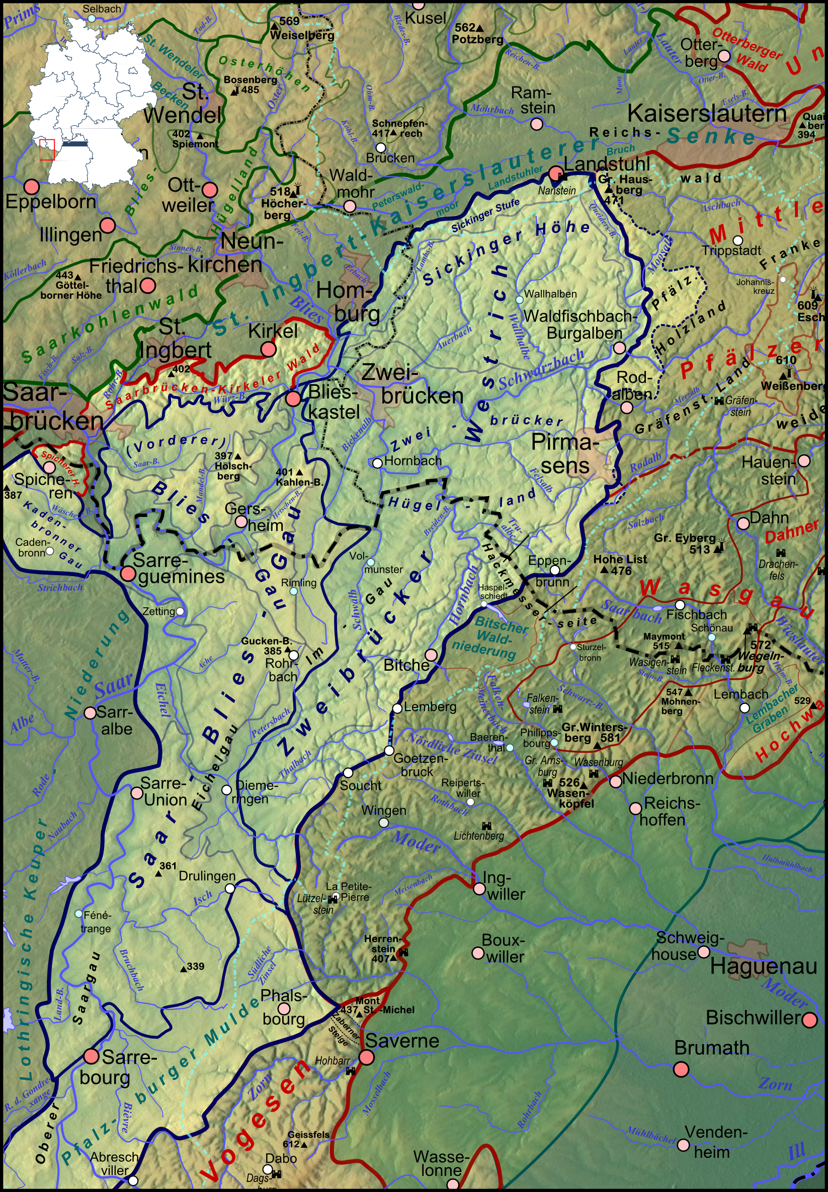
Deutsch: Das Pfälzisch-Saarländische Muschelkalkgebiet (aufgehellt, dunkelblaue Grenzziehung und Beschriftungen) im westlichen Anschluss an den Pfälzerwald nebst südlicher Fortsetzung nach Lothringen; der aufgehellte Bereich rechts der dicken blauen Linie war in der naturräumlichen Gliederung dem Zweibrücker Westrich zugerechnet worden, zählt aber landläufig bereits zum Pfälzerwald (und liegt auch in dessen Naturpark) |
| Date | |
| Source |
Own work
|
| Author | Elop, based on work by Lencer |
| Other versions |
|
Licensing
[edit]

|
Permission is granted to copy, distribute and/or modify this document under the terms of the GNU Free Documentation License, Version 1.2 or any later version published by the Free Software Foundation; with no Invariant Sections, no Front-Cover Texts, and no Back-Cover Texts. A copy of the license is included in the section entitled GNU Free Documentation License. |
File history
Click on a date/time to view the file as it appeared at that time.
| Date/Time | Thumbnail | Dimensions | User | Comment | |
|---|---|---|---|---|---|
| current | 16:29, 1 February 2012 | | 1,646 × 2,369 (6.29 MB) | Elop (talk | contribs) | == Summary == {{Information |Description ={{de|1=Das Pfälzisch-Saarländische Muschelkalkgebiet (aufgehellt, dunkelblaue Grenzziehung und Beschriftungen) im westlichen Anschluss an den [[:de:Pfälze |
You cannot overwrite this file.
File usage on Commons
The following page uses this file:
File usage on other wikis
The following other wikis use this file:
- Usage on de.wikipedia.org