File:Perisoreus canadensis 0729.JPG
Jump to navigation
Jump to search
Size of this preview: 800 × 533 pixels. Other resolutions: 320 × 213 pixels | 640 × 427 pixels | 1,024 × 683 pixels | 1,280 × 853 pixels | 2,560 × 1,707 pixels | 4,272 × 2,848 pixels.
Original file (4,272 × 2,848 pixels, file size: 2.2 MB, MIME type: image/jpeg)
Captions
Captions
Add a one-line explanation of what this file represents
| Description |
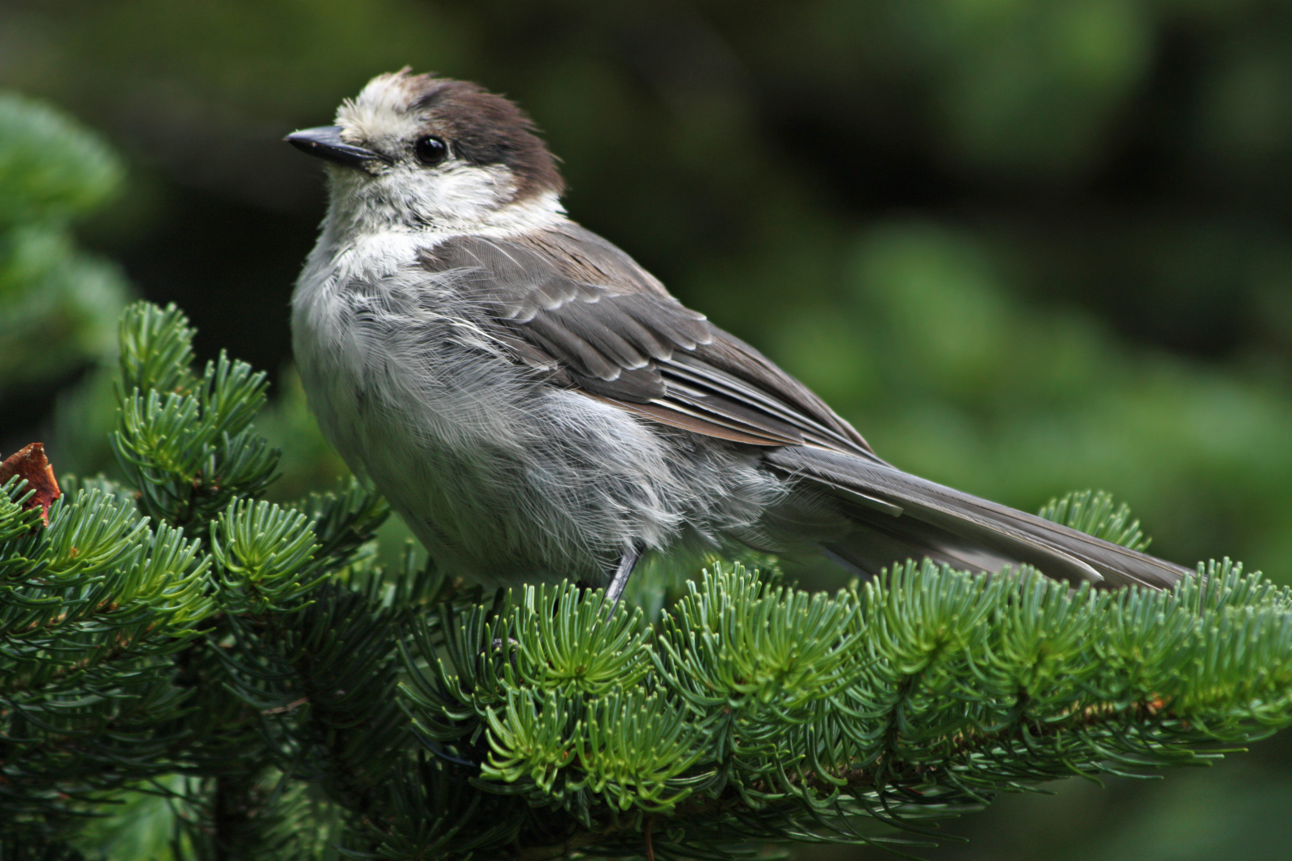
Perisoreus canadensis English: Gray Jay on Subalpine Fir (Abies lasiocarpa) |
| Date | 11 August 2008, 14:44:18 −07:00 |
| Source | Own work |
| Author | Walter Siegmund (talk) |
| Other versions |
|


| Camera location | | View this and other nearby images on: OpenStreetMap |
|---|
- Location source: Garmin GPSmap 60CSx
- Location Datum: WGS84
- Viewpoint location: Lakes Trail (Mazama Ridge), Mount Rainier National Park
- Viewpoint elevation: 1613 meter (5291 ft)
- Camera: Canon EOS DIGITAL REBEL XSi
- Exposure Time: 1/250
- F Number: f/5.6
- Focal Length: 300.0
- ISO Speed Rating: 200
©2010 Walter Siegmund
Licensing
[edit]
I, the copyright holder of this work, hereby publish it under the following licenses:

|
Permission is granted to copy, distribute and/or modify this document under the terms of the GNU Free Documentation License, Version 1.2 or any later version published by the Free Software Foundation; with no Invariant Sections, no Front-Cover Texts, and no Back-Cover Texts. A copy of the license is included in the section entitled GNU Free Documentation License. |
This file is licensed under the Creative Commons Attribution-Share Alike 3.0 Unported, 2.5 Generic, 2.0 Generic and 1.0 Generic license.
- You are free:
- to share – to copy, distribute and transmit the work
- to remix – to adapt the work
- Under the following conditions:
- attribution – You must give appropriate credit, provide a link to the license, and indicate if changes were made. You may do so in any reasonable manner, but not in any way that suggests the licensor endorses you or your use.
- share alike – If you remix, transform, or build upon the material, you must distribute your contributions under the same or compatible license as the original.
You may select the license of your choice.
File history
Click on a date/time to view the file as it appeared at that time.
| Date/Time | Thumbnail | Dimensions | User | Comment | |
|---|---|---|---|---|---|
| current | 03:07, 18 May 2015 | | 4,272 × 2,848 (2.2 MB) | Wsiegmund (talk | contribs) | Adobe Photoshop Elements 11.0; 20% Auto Smart Fix, Adjust Lighting/Shadows/Highlights; selective noise reduction |
| 01:43, 5 January 2010 |  | 4,272 × 2,848 (3.52 MB) | Wsiegmund (talk | contribs) | {{Information |Description=Lakes Trail (Mazama Ridge), Mount Rainier National Park |Source={{Own}} |Date=2008:08:11 |Author=Walter Siegmund (talk) |Permission=Own work, attribution required |
You cannot overwrite this file.
File usage on Commons
The following 6 pages use this file:
File usage on other wikis
The following other wikis use this file:
- Usage on ar.wikipedia.org
- Usage on ceb.wikipedia.org
- Usage on en.wikipedia.org
- Usage on fr.wikipedia.org
- Usage on hu.wikipedia.org
- Usage on it.wikipedia.org
- Usage on ru.wikipedia.org