File:Pavis Wood - geograph.org.uk - 1240778.jpg
Jump to navigation
Jump to search

Size of this preview: 784 × 600 pixels. Other resolutions: 314 × 240 pixels | 628 × 480 pixels | 1,004 × 768 pixels | 1,259 × 963 pixels.
Original file (1,259 × 963 pixels, file size: 836 KB, MIME type: image/jpeg)
Captions
Captions
Add a one-line explanation of what this file represents
Summary
[edit]
| Description |
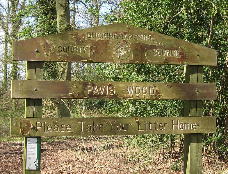
English: Pavis Wood This is a large ancient woodland with a wide variety of plants. It is dominated by beech, oak and ash. Several footpaths cross the site. Flowers to look out for include Hairy Wood-rush, Pignut, Yellow Pimpernel, Bluebell, Wood Mellick and Spurge Laurel. The wood, which contains the Ridgeway and Chiltern Way trails, is in Buckinghamshire http://www.aylesbury.gov.uk/leisure-culture/countryside/places-to-visit/pavis-wood/.
There is a potential confusion because the Pavis Wood is on the west side of the boundary bridleway between Hertfordshire and Buckinghamshire, with Dog Wood being on the Hertfordshire side. A spot height on OS Maps on the edge of the wood happens to be on the Hertfordshire side of the boundary and is the highest point in Hertfordshire at 244 metres above sea level. However the summit area is so flat that the exact location of the spot height which forms the peak must have been somewhat arbitrary. Because it is the Hertfordshire peak, Pavis Wood is listed as a hill in Hertfordshire on Wikipedia Pavis_Wood and sites such as Peakbagger http://www.peakbagger.com/ Many web sites claim that the wood itself is in Hertfordshire and that the Buckinghamshire border is three miles away which is clearly nonsense. I suspect that 3 miles is misreading of 3m meaning 3 metres. |
| Date | |
| Source | From geograph.org.uk |
| Author | Chris Reynolds |
| Attribution (required by the license) | Chris Reynolds / Pavis Wood / |
| Camera location | | View this and other nearby images on: OpenStreetMap |
|---|
_heading:315.00&language=en)
| Object location | | View this and other nearby images on: OpenStreetMap |
|---|
_heading:315.00&language=en)
Licensing
[edit]

|
This image was taken from the Geograph project collection. See this photograph's page on the Geograph website for the photographer's contact details. The copyright on this image is owned by Chris Reynolds and is licensed for reuse under the Creative Commons Attribution-ShareAlike 2.0 license.
|
This file is licensed under the Creative Commons Attribution-Share Alike 2.0 Generic license.
Attribution: Chris Reynolds
- You are free:
- to share – to copy, distribute and transmit the work
- to remix – to adapt the work
- Under the following conditions:
- attribution – You must give appropriate credit, provide a link to the license, and indicate if changes were made. You may do so in any reasonable manner, but not in any way that suggests the licensor endorses you or your use.
- share alike – If you remix, transform, or build upon the material, you must distribute your contributions under the same or compatible license as the original.
File history
Click on a date/time to view the file as it appeared at that time.
| Date/Time | Thumbnail | Dimensions | User | Comment | |
|---|---|---|---|---|---|
| current | 00:26, 7 September 2017 | | 1,259 × 963 (836 KB) | Geograph Update Bot (talk | contribs) | Higher-resolution version from Geograph. |
| 17:18, 26 February 2011 |  | 628 × 480 (258 KB) | GeographBot (talk | contribs) | == {{int:filedesc}} == {{Information |description={{en|1=Pavis Wood This is a large ancient woodland with a wide variety of plants. It is dominated by beech, oak and ash. Several footpaths cross the site. Flowers to look out for include Hairy Wood-rush, P |
You cannot overwrite this file.
File usage on Commons
The following page uses this file: