File:Pauini River, Amazonas.jpg
Jump to navigation
Jump to search

Size of this preview: 800 × 450 pixels. Other resolutions: 320 × 180 pixels | 640 × 360 pixels | 1,024 × 576 pixels | 1,280 × 720 pixels | 2,669 × 1,501 pixels.
Original file (2,669 × 1,501 pixels, file size: 1.83 MB, MIME type: image/jpeg)
Captions
Captions
Add a one-line explanation of what this file represents
Summary
[edit]
| Description |
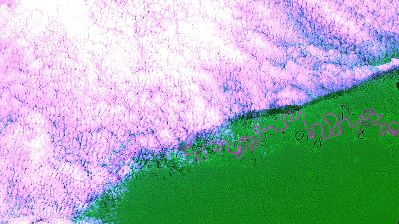
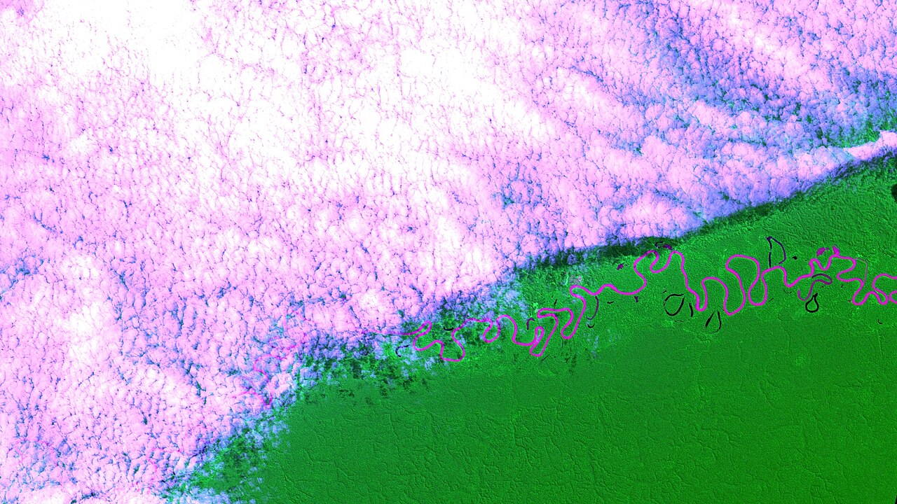
Português: Rio Pauini, 120 km em linha reta de Pauini, Amazonas, que fica um pouco abaixo de onde o rio deságua no Rio Purus. Nessa imagem falsa-cor, onde o infravermelho próximo substitui o verde, água barrenta aparece em rosa e água clara em preto. Floresta em verde, nuvens em branco roseado e suas sombras em preto / Pauini River, 75 mi (straight-line) from Pauini town, a lttle downriver from where it drains into Purus River. Muddy water appears in pink and clear water in black, at this false-color image, where near infrared replaces green. Forest in green, clouds in rosy white and its shadows in black.
Imagem / Image CBERS4 MUX Rio Pauini / Pauini River, Amazonas. Coordenadas do centro da imagem / Image center: 7°21'39.8"S 68°01'56.4"W Data / Date: 16-05-2019 / 2019-16-05 RGB785 (falsa cor / false color) Cena / Scene: 181 / 108 Autor / Author: Oton Barros (DSR/OBT/INPE) Imagem em HD / HD Image Visite-nos / Visit us: www.dsr.inpe.br |
| Date | |
| Source | https://www.flickr.com/photos/153282474@N02/46953544025/ |
| Author | Coordenação-Geral de Observação da Terra/INPE |
Licensing
[edit]
This file is licensed under the Creative Commons Attribution-Share Alike 2.0 Generic license.
- You are free:
- to share – to copy, distribute and transmit the work
- to remix – to adapt the work
- Under the following conditions:
- attribution – You must give appropriate credit, provide a link to the license, and indicate if changes were made. You may do so in any reasonable manner, but not in any way that suggests the licensor endorses you or your use.
- share alike – If you remix, transform, or build upon the material, you must distribute your contributions under the same or compatible license as the original.
| This image was originally posted to Flickr by Coordenação-Geral de Observação da Terra/INPE at https://flickr.com/photos/153282474@N02/46953544025. It was reviewed on 9 April 2020 by FlickreviewR 2 and was confirmed to be licensed under the terms of the cc-by-sa-2.0. |
File history
Click on a date/time to view the file as it appeared at that time.
| Date/Time | Thumbnail | Dimensions | User | Comment | |
|---|---|---|---|---|---|
| current | 10:13, 9 April 2020 | | 2,669 × 1,501 (1.83 MB) | Jo-Jo Eumerus (talk | contribs) | Uploaded a work by Coordenação-Geral de Observação da Terra/INPE from https://www.flickr.com/photos/153282474@N02/46953544025/ with UploadWizard |
You cannot overwrite this file.
File usage on Commons
The following 2 pages use this file:
.jpg&redirect=no)
File usage on other wikis
The following other wikis use this file:
- Usage on arz.wikipedia.org
- Usage on ceb.wikipedia.org
- Usage on en.wikipedia.org
- Usage on www.wikidata.org